About Martin Eayrs

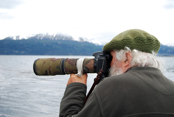
San Martín de los Andes, Neuquén, Argentina This blog is an occasional dumping/sharing ground for random thoughts and ideas, mainly relating to birding, photography, travel, the English language and the teaching thereof and assorted verse and doggerel. I am a retired teacher/lecturer and now work as a language and education consultant with an interest in evaluation and testing, quality assessment and moderation. I divide my time between homes and families in San Martín de los Andes, Patagonia and Manchester, UK.

RN40 south – some stats

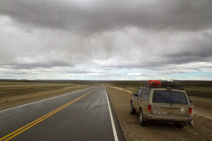
I spent 31 days on the road and travelled a total distance of 9,964 kilometres (6,192 miles)

My average km per litre was 7.46 (17.55 mpg) – but this varied enormously day on day according to road surface and need for 4WD.

I slept in 15 hostels, 10 hosterias, 2 campsites, 1 hotel, 1 motel, 1 Bed & Breakfast and 1 night in the car

I registered at least 114 bird species (+ quite a few unknowns) and photographed 40 species that were ‘new’ to me, quite a few endemic to the areas I visited.

Miraculously, I kept my total costs within budget.

RN40 – epilogue


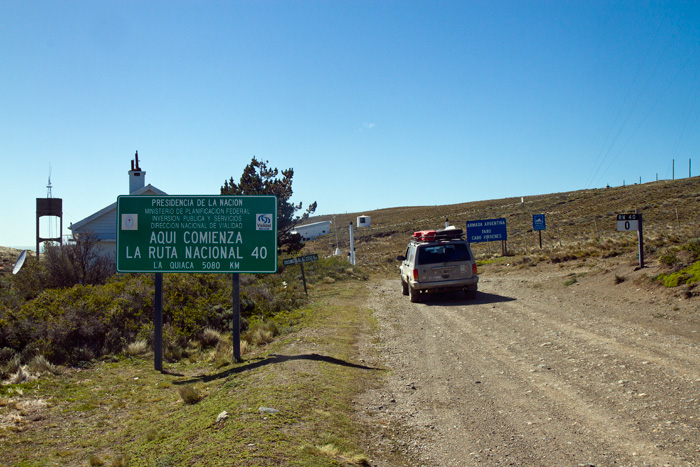
Until 2004 the Ruta 40 finished its southern trajectory at Punta Loyola, near Río Gallegos. In 2004, mostly for political reasons, an additional 100 km was added, making the new starting point [kilometre zero] at Cabo de Virgenes, where the Magellan Straits meet the South Atlantic.

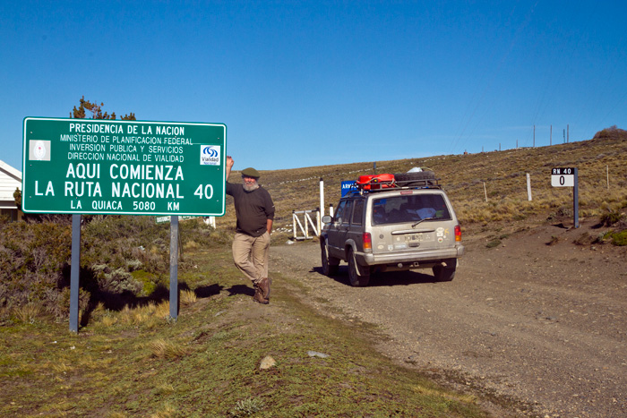
Arrived at the beginning of the RN 40

Arrived at the beginning of the RN 40

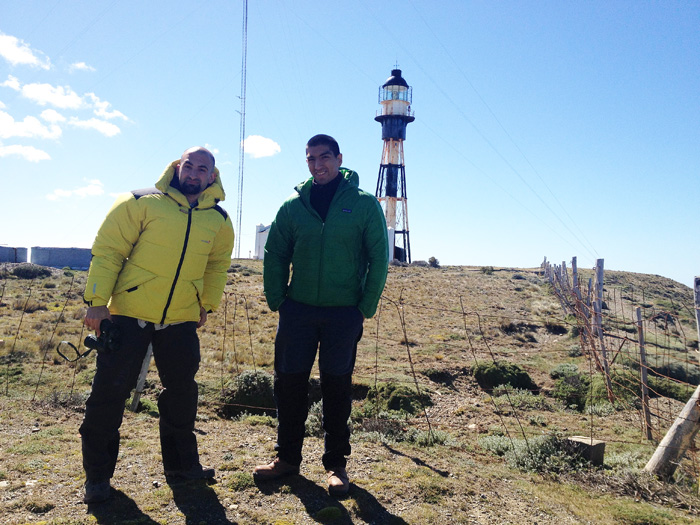
Mission complete, as Silver and I arrive at Cabo de Virgenes. Pity Tiso wasn’t with us to celebrate but he did most of the journey and I missed him especially on this last leg. But I did have company – I picked up a couple of fellow birders from Río Gallegos whom I knew through Aves Argentinas and they provided excellent company as well as good birding info (see separate blog under ‘Birds and Birding – Trip to Cabo de Virgenes’).

My birding companions for the day, Emanuel and Santiago

My birding companions for the day, Emanuel and Santiago

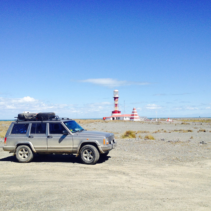
In the background you can see the old lighthouse at Cabo de Virgenes – I declined the invitation to climb to the top because of a) the howling wind, b) my age and relative infirmity and c) my sense of vertigo. Oh to be young again.

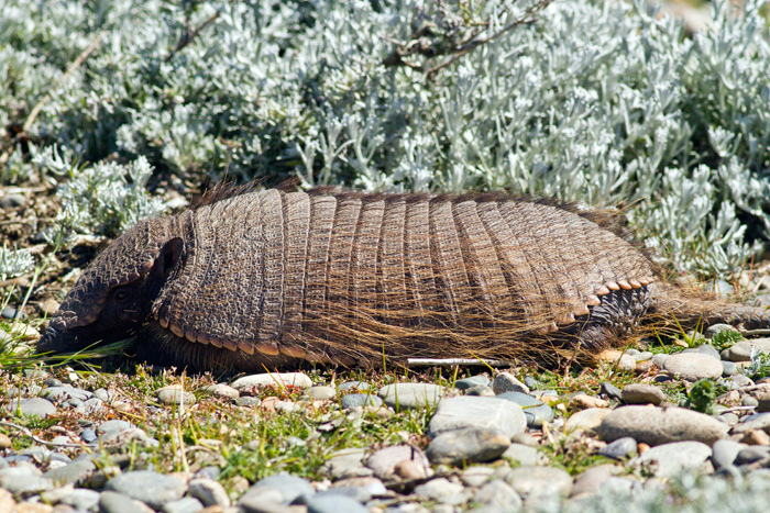
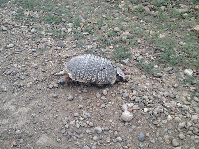
An armadillo, apparently asleep or sun bathing

An armadillo, apparently asleep or sun bathing

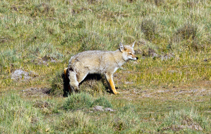
A grey fox going about his business

A grey fox going about his business

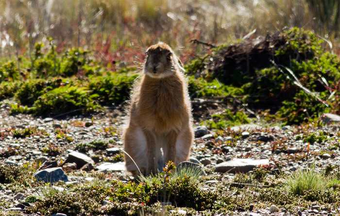
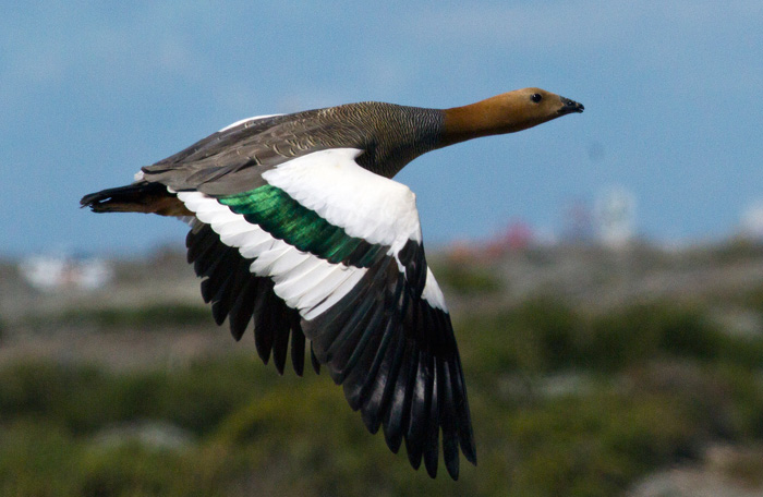
We saw plenty of wild life on the way down, some pictured here. Plenty of birds too, but not for this blog – except perhaps to mention the Cauquen Colorado, a dying species in Argentina but fortunately with a breeding population in the nearby Falklands/Malvinas islands.

A curious hare, ears for once pinned back

A curious hare, ears for once pinned back

A rare sight in Argentina - the coquina Colorado, or ruddy-headed goose.

A rare sight in Argentina – the Cauquen Colorado, or ruddy-headed goose.

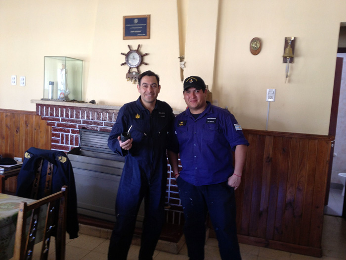
Cabo de Virgenes is a long and rough ride, 0ver a hundred km of bad potholes (and I mean ‘bad’), and the Navy personnel who look after the base there don’t get too many visitors so they were delighted to invite us to lunch – lashings of milanesas and rice. We had a long and enlightening chat, mostly about the Malvinas/Falklands situation. All very civilised, and a long way from the fireworks and histrionics of 1982. Good vibes.

We were invited to lunch (rice and milanesas) by the permanent Armada Argentina team

Mateando with the permanent Armada Argentina team

We also travelled a little further south to the Chilean border at Punta Dúngeness, named after the English headland.

Punta Dúngeness, where Chile has its only access to the Atlantic

The lighthouse at Punta Dúngeness, where Chile has its only access to the Atlantic

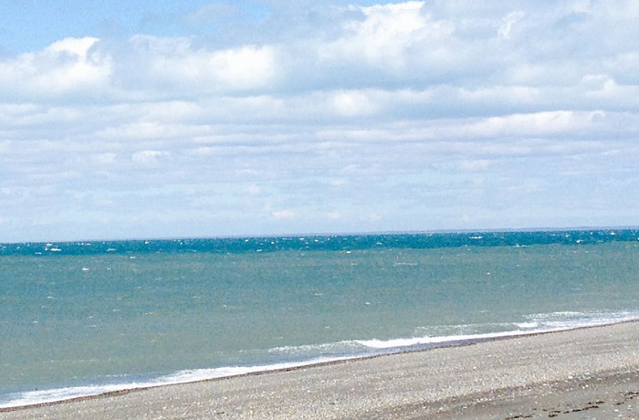
layer cake: the change in colour of the water marks where the Magellan Straits meet the South Atlantic Ocean

Layer cake: the change in colour of the water marks where the Magellan Straits meet the South Atlantic Ocean

And so it is. Silver and I made it, with Tiso covering all except the last little bit – which is a 2004 add-on anyway. Next year, La Quiaca, and my final photo is in a sense the start of that journey.

And this is where next year's trip has already started - will Silver make it to La Quiaca in November 2015?

And this is where next year’s trip has already started – will Silver make it to La Quiaca in November 2015? Watch this space.

RN40 – end of the world

Day: 11-14
Trajectory: In and around Ushuaia

Distance covered:   unknown but unimportant


Our journey south is pretty much finished now bar the last hop of the RN40 from Rio Gallegos to Cabo Virgenes, which Martín will do alone. This blog post will describe some of the things we did in Ushuaia before Tiso took the plane back home to San Martín.

Hostería - comfy but not much character

Hostería – comfy but not much character

Tiso and I stayed for four nights in Ushuaia and I stayed alone for one more. It is not on the RN40, but it was as far as Tiso was going and a great place to visit, with  a lot for the tourists of all ages to see and do.

Hostel - full of backpackers, very friendly.

Hostel (lit) – full of backpackers, very friendly.

Because of previous bookings we alternated between a hostel and a hosteria, practically next door to each other. Both comfortable, and the hostel (as one would probably expect) remarkably friendly.

Martin in total photographic bliss on an excursion to Isla Martillo

Martin in total photographic bliss on an excursion to Isla Martillo

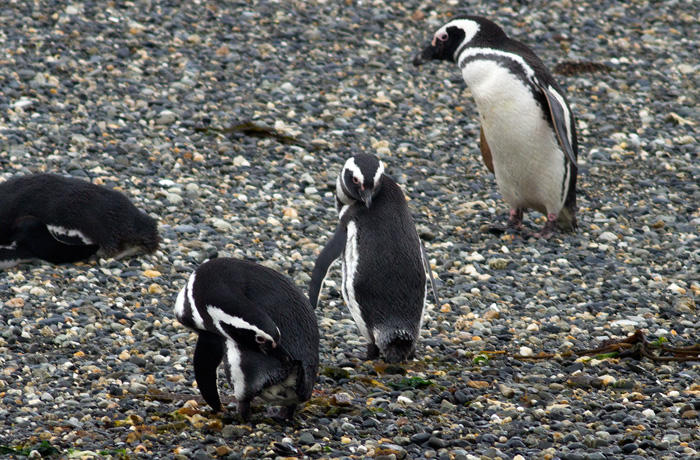
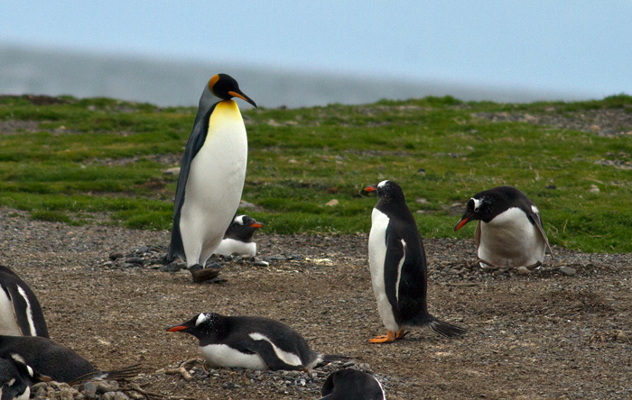
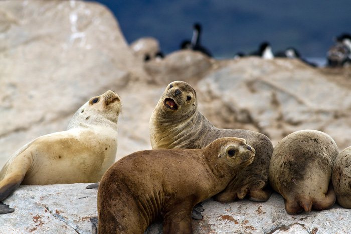
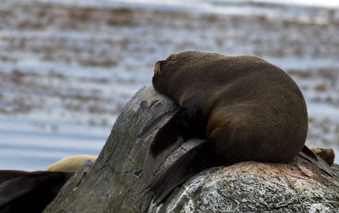
On our first day we went on a sea trip and saw lots of wild life: here are a few examples:

Magellanic penguins

Magellanic penguins

One King penguin in the company of several Gentoo penguins

One King penguin in the company of several Gentoo penguins

Fur seals

Fur seals

Sleeping sea lion

Sleeping sea lion

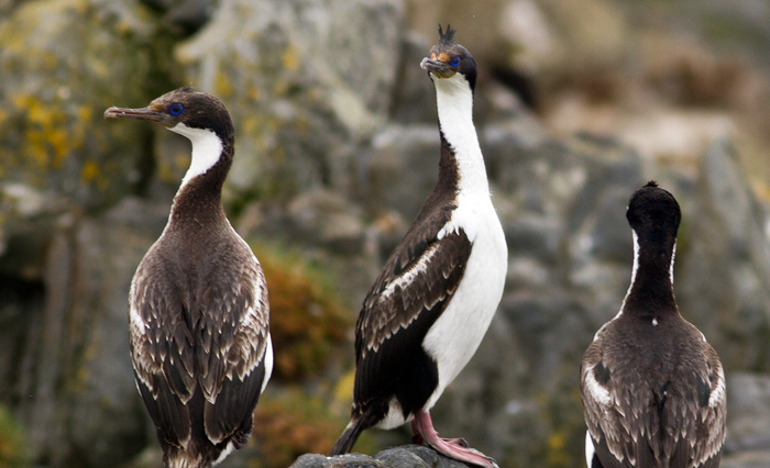
Imperial shags - note the piercing blue eyes

Imperial shags – note the piercing blue eyes

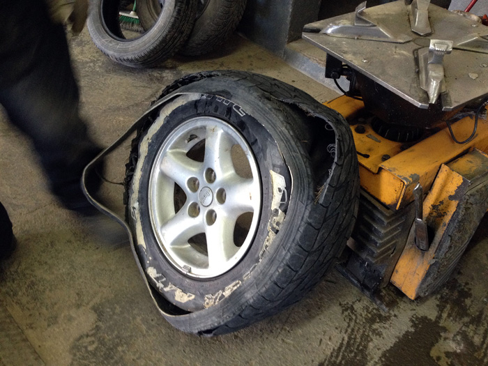
Our first priority was to get the the spare wheel fixed – here’s a reminder of what it looked like after the volcanic rock had attacked it:

The remains of a tyre that we had to replace.

The remains of a tyre that we had to replace.

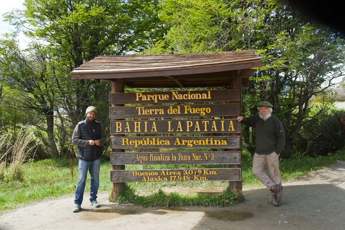
That done, we continued with our tourism in Ushuaia. On our second day we visited the Tierra del Fuego National Park, where we had our obligatory photograph taken at the end of terrestial Argentina.

Obligatory photo for tourists who reach the end of the world

Obligatory photo for tourists who reach the end of the world

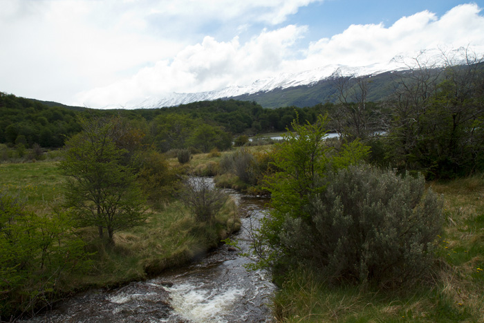
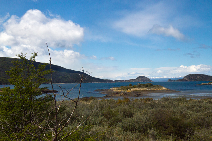
The national park is spectacular and the weather surprisingly mild – with quite a few people camping there.

National Park of Tierra del Fuego - View 1

National Park of Tierra del Fuego – View 1

National Park of Tierra del Fuego - View 2

National Park of Tierra del Fuego – View 2

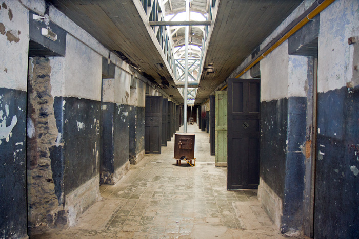
We also visited a fascinating museum in the old Prison, very well worth a visit.

Prison museum - one of the main corridors

Prison museum – one of the main corridors

The museum told a lot of the history of Ushuaia itself, as well as the lives of the prisoners and their guards who had lived there.

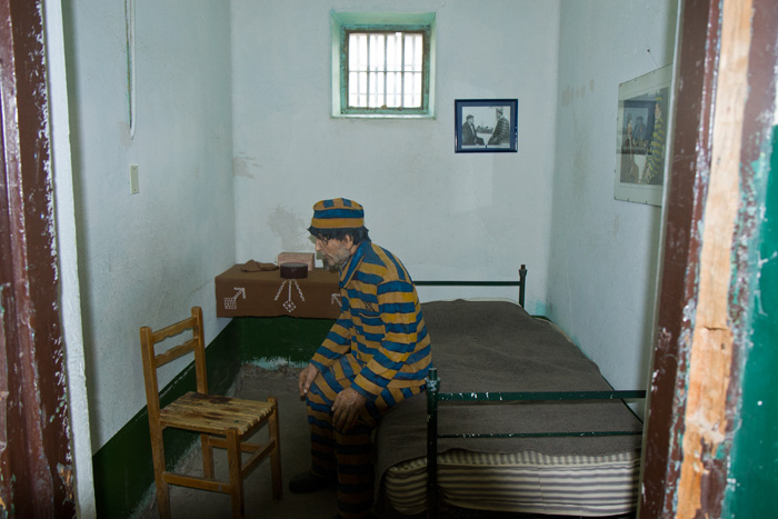
Many of the cells had been used as exhibits of different kinds: this one to show how a typical prisoner lived

Many of the cells had been used as exhibits of different kinds: this one to show how a typical prisoner lived

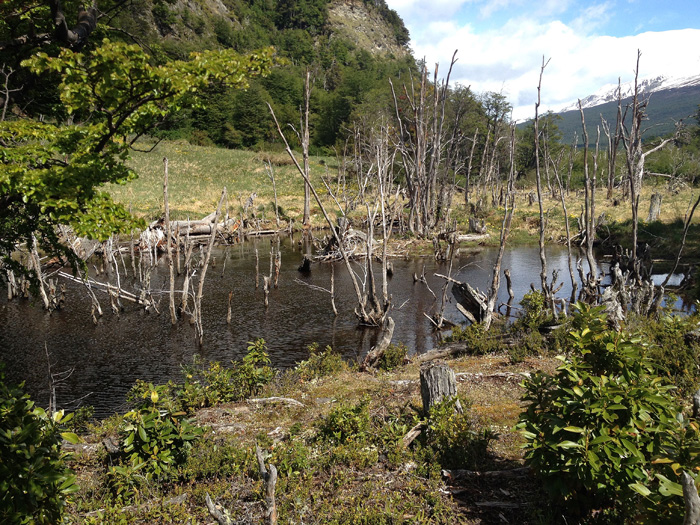
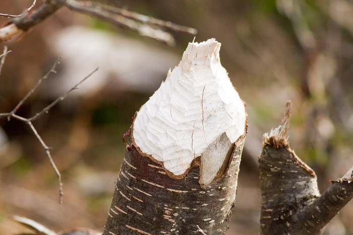
Tiso left by plane and I went back to the National Park to do some birding. There was evidence of beavers and the damage they have caused since their introduction almost everywhere.

Evidence of beaver damage was everywhere in Tierra del Fuego

Evidence of beaver damage was everywhere in Tierra del Fuego

Beavers would make good pencil sharpeners

Beavers would make good pencil sharpeners

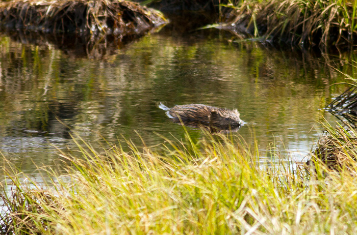
And here is one of the culprits:

The culprit, swimming innocently in a channel

The culprit, swimming innocently in a channel

And I was left alone in Ushuaia, with the long journey up the Atlantic coast of Patagonia ahead of me. But that belongs to another blog.

RN40 south, day 10

Day: 10
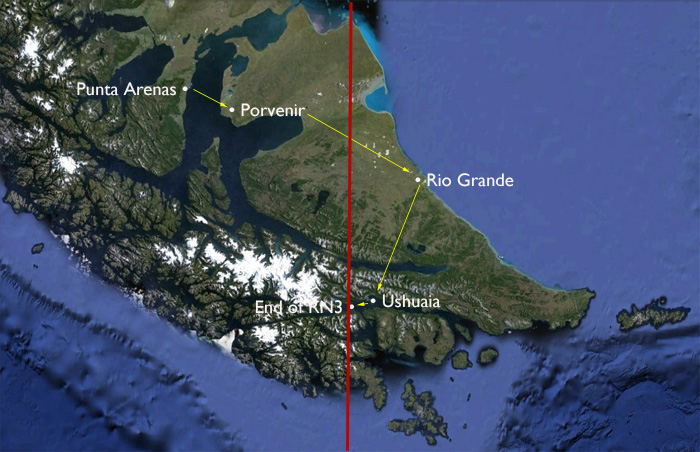
Trajectory: Punta Arenas – Porvenir – San Sebastian – Río Grande – Ushuaia

Distance covered:   489 km


The last leg of the journey south was from Punta Arenas to Ushuaia, where we intended to rest up for a few days. Tiso would then fly back to San Martín de los Andes [via Buenos Aires and Neuquén] and I would drive slowly back up the Atlantic coast, filling in the missing bits of the RN40.

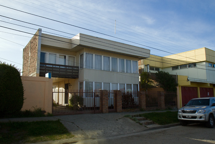
B&B in Punta Arenas, run by a friendly if rather odd old lady

B&B in Punta Arenas, run by a friendly if rather odd old lady

We spent the night in Punta Arenas in a very strange B&B, run by an even stranger old Lady. After an early breakfast, during which she stood over us while we ate, we were off to Tierra del Fuego, jointly owned and accupied by Chile and Argentina.

Route of the day (not driven in straight lines, however!)

Route of the day (not driven in straight lines, however!). Chile to the left of the red line.

It is easy to forget which country you are in down here, as there are ferrys that are not borders and inland frontiers which are not ferries. But all our crossings went smoothly and quickly, and we were blessed by good weather.

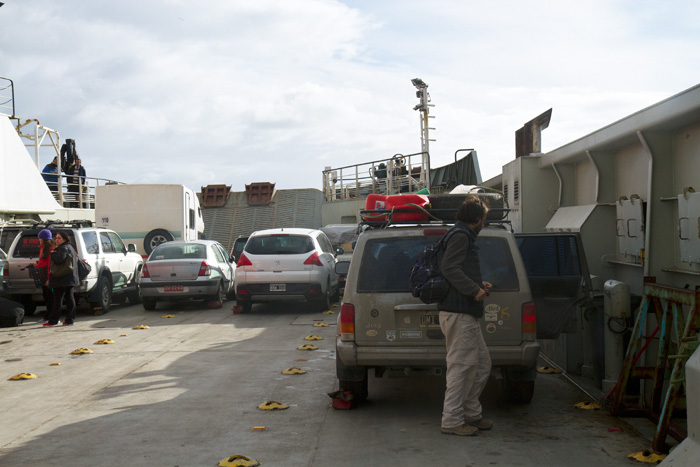
Boarding the ferry from Punta Arenas to Porvenir

Boarding the ferry from Punta Arenas to Porvenir

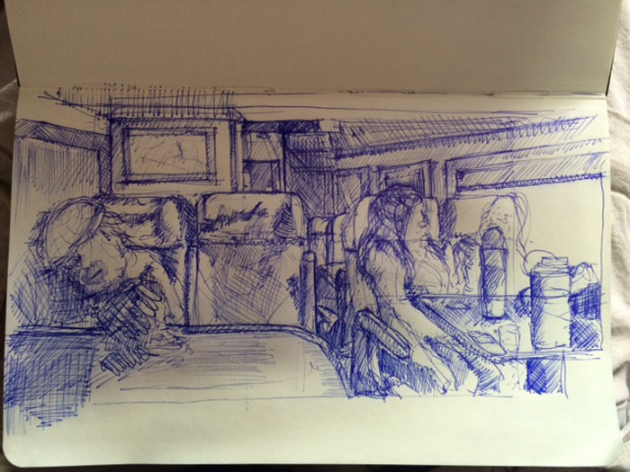
We took the ferry from Punta Arenas to Porvenir, still in Chile. One of us slept on the ferry while the other dropped into sketching mode.

Blog owner catching up on his sleep while Tiso has an artistic moment

Blog owner catching up on his sleep while Tiso has an artistic moment

As you can see, it was a comfortable ride.

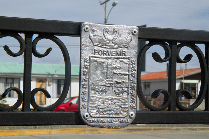
A snapshot of Porvenir, which we hardly visited in our haste to drive on

A snapshot of Porvenir, which we hardly visited in our haste to drive on

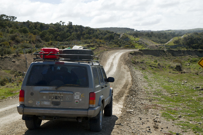
Soon we were in Porvenir and on firm land again, back on the road and driving West to the border with Argentina at San Sebastian. It was good to be on the road again.

On the road again after our ferry ride

On the road again after our ferry ride

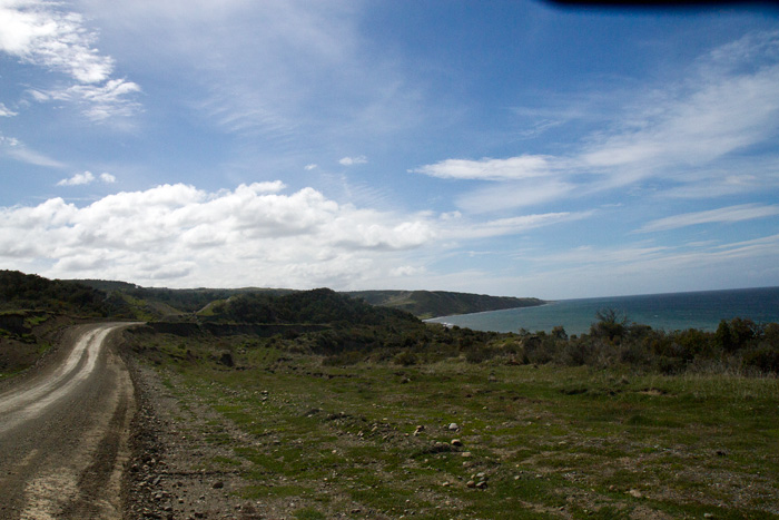
We were now in Tierra del Fuego, the Chilean part. Our road at first hugged the coastline, with some spectacular views:

We hugged the shore line for the first part of the day's driving

We hugged the shore line for the first part of the day’s driving

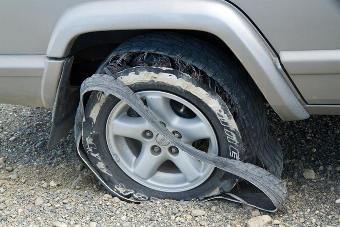
Everything was fine until half away along the inland road we were given a lesson in just how sharp the volcanic rock on the roads down here can be:

Victims of super-sharp volcanic rock

Victims of super-sharp volcanic rock

These things happen, and to be fair we had been warned about this. We were carrying two spares but this one was beyond repair and would clearly need to be replaced at the first opportunity. One down and one to go. As Tiso commented, we were using just about everything we had packed for ’emergencies’ like this.

Wheel changed, and kept for the alloy wheel only. Back on our way.

Wheel changed, and kept for the alloy wheel only. Back on our way.

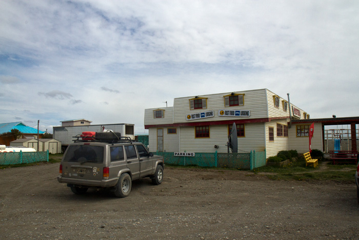
We stopped for a bite to eat and eventually hit the town of San Sebastian (Chile) where we got a bite to eat.

Another remote eating place, one of so many we stopped at during our journey

Another remote eating place, one of so many we stopped at during our journey

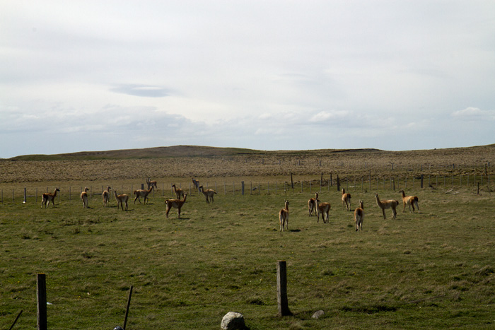
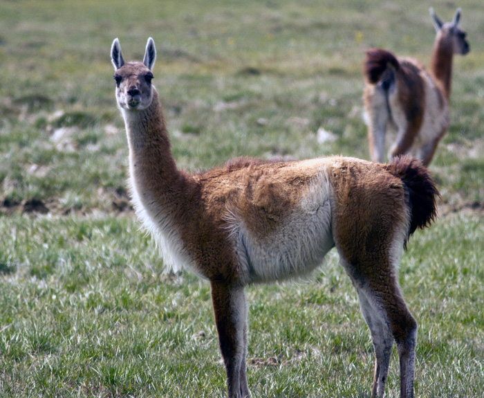
We drove across the two frontier posts and were now back in Tierra del Fuego, the Argentine part. Our next stop would be Rio Grande if we chose to stop there. We were accompanied along this road –as in much of Tierra de Fuego– by flocks of guanaco, some super timid and some cautiously curious of us.

One of a great many flocks of guanaco that we saw

One of a great many flocks of guanaco that we saw 

The guanaco are not fenced in, but roam wild. They are excellent at jumping fences to get to greener grass or to escape passing Jeeps. I began to like the guanacos; they are dignified, independent and essentially free.

Closer view of guanaco - such curious animals

Closer view of guanaco – such curious animals

Back in Argentina it was still flat, open country. We decided to drive on to Ushuaia and drove right by Rio Grande (I would visit it on the way north). As we drove closer to Ushuaia we came back into a mountainous area – although not as high as the Andes further north they still offer spectacular views.

Back in the mountains as we continue south to Ushuaia

Back in the mountains as we continue south to Ushuaia

We arrived in Ushuaia in the evening, tired but well, and fixed up lodgings for a few nights in a hostal and a hosteria, side by side, alternating as bookings at each were tight but between the two we managed.  More in the next blog.


RN40 south, day 9

Day: 9
Trajectory: El Calafate – Tapi Aike – Punta Arenas – Puerto Hambre – Punta Arenas

Distance covered:   624 km
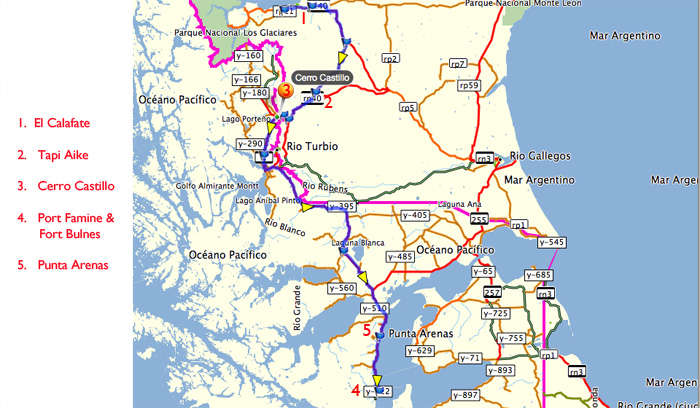
 

Kilometres covered in day 9

Kilometres covered in day 9

Day 9 was a day in which we drastically changed our plans, revising both route and destination in an attempt to make best use of the time left to us before Tiso had to fly back from Ushuaia. The weather also had a great deal to do with plans and execution.
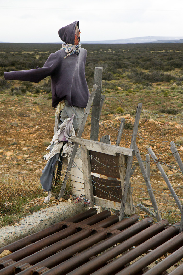
Scarecrow figure by the side of the road as we leave Calafate. The text says "Don't do as I did: leave a tip"

Scarecrow figure by the side of the road as we leave Calafate. The text says “Don’t do as I did: leave a tip”

We got away from El Calafate in good time and drove down towards Cerro Castillo (in Chile) from which we intended to visit the Paine National Park. It was to be another day with much gravel surface.
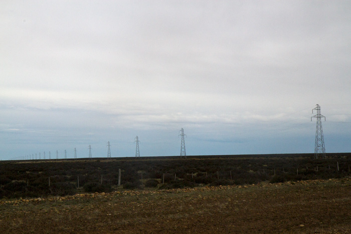
Pylons stretch across the plain to the distant horizon

Pylons stretch across the plain to the distant horizon

We drove across long flat plains, taking a short cut down the R70 and rejoining the RN40 at the remote, windswept outpost of Tapi Aike, where we fuelled and I unfortunately asked for a coffee. The coffee took forever, as the woman at the stop had to individually locate cup, water, the means to heat it, coffee and milk. It was undrinkable, but after all that I felt I had to get it down.
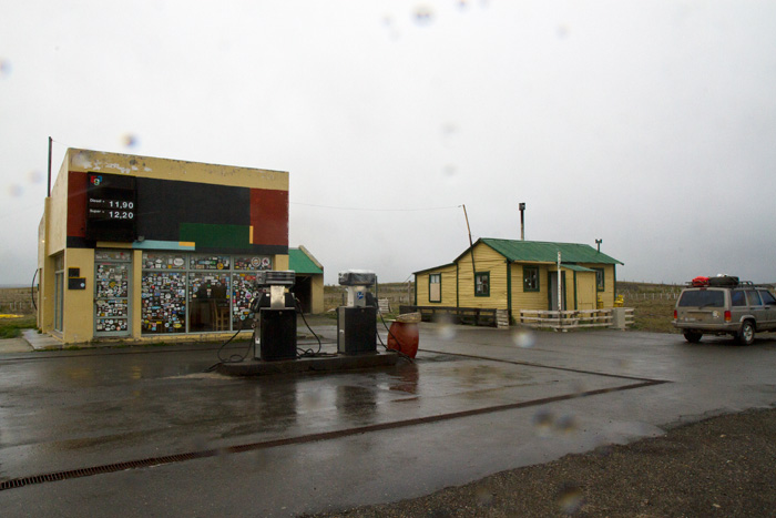
Fuel stop at remote, cold, wet and extremely windy Tapi Aike

Fuel stop at remote, cold, wet and extremely windy Tapi Aike

The couple who run this gas station live in the middle of nowhere, and it really is a cold, wet, windy and god-forsaken place. All they have is the filling station and their leaky tin house. The previous incumbents left suddenly and the current residents have only been there two months – I doubt they will stay much longer. Little traffic goes by, but it is an essential stop as it is the only filling station for hundreds of kilometres.
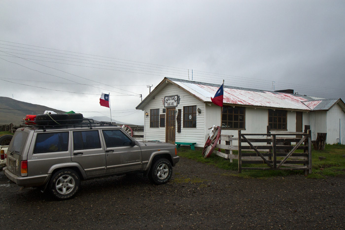
Entering Chile at Cerro Castillo

Entering Chile at Cerro Castillo

From Tapi Aike we reached the Chilean border at Cerro Castillo without problems and had a decent cup of coffee and a bite to eat. Cerro Castillo was a small but not unattractive town which took us all of five minutes to explore.
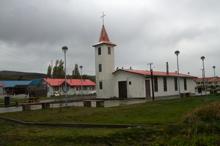
Church and street view - Cerro Castillo

Church and street view – Cerro Castillo

We had come to Cerro Castillo to visit the Paine national park, with its spectacular peaks and scenery. But visibility was appalling and to drive 80 kms there and the same back to look at dark clouds and sky seemed pointless so we cut our losses and set ourselves to study the map.
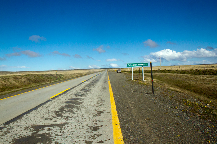
Driving south through Chile - with their typical efficiency they had regular lay-bys where travellers could stop and brew mate ....

Driving south through Chile – with their typical efficiency they had regular lay-bys where travellers could stop and brew mate ….

We decided to drive south through Chile to Punta Arenas and further south, and then to cross to Tierra del Fuego by ferry through the Chilean town of Porvenir. From here we could drive down to Ushuaia where Tiso had to catch his plane back to San Martín de los Andes. This fit our plans best, allowing Tiso to see some of what he wanted while ensuring he would be at the airport with time to spare. I would fill in the missing RN40 bits later by myself, most importantly the final bit from Rio Gallegos down to Cabo Virgenes, where the 0 km marker awaited a photo of Silver and I.
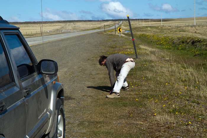
... or in the case of Tiso stretch legs tired from so much walking and driving

… or in the case of Tiso stretch legs tired from so much walking and driving

Initially we drove right by Punto Arenas in order to visit Port Famine (Sp. Puerto de Hambre), the geographical centre of Chile. That surprised me, but it is the midway point between the South Pole (which Chile claims) and its northern border with Peru. Just short of Port Famine we saw the grave of Pringle Stokes, who commanded HMS Beagle on its first voyage of exploration in the south Atlantic. The harsh winter conditions of the Strait of Magellan were too much for him and he committed suicide; the commander of the second voyage of the Beagle was Fitzroy.
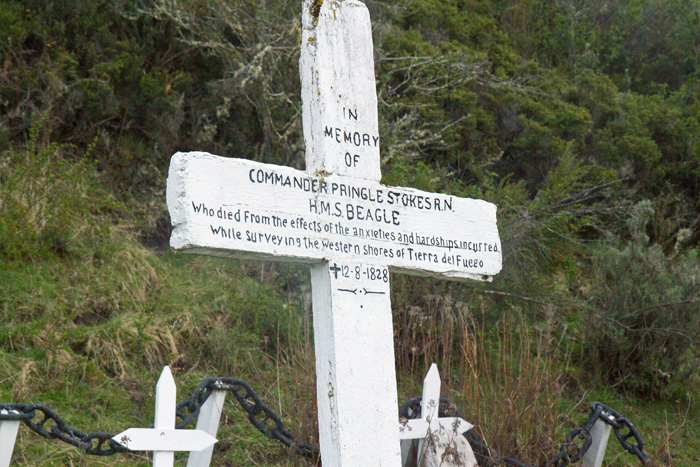
Grave of Pringle Stokes, commander of HMS Beagle's first voyage, who committed suicide there in a fit of depression

Grave of Pringle Stokes, commander of HMS Beagle’s first voyage, who committed suicide there in a fit of depression

We drove on as far as the turn for Port Famine and Fort Bulnes, some 62 kms south of Punta Arenas.
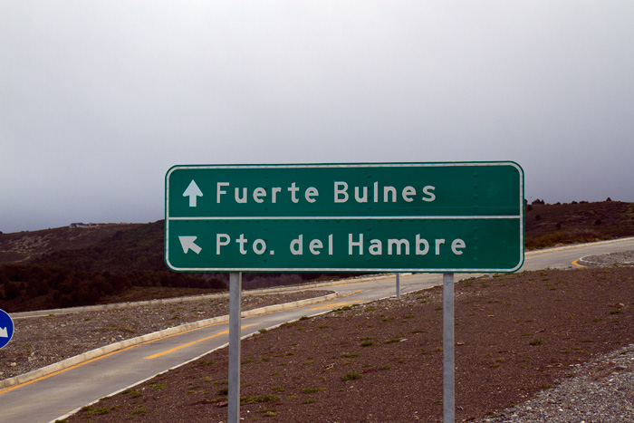
This was about as far south as we got by road ....

This was about as far south as we got by road ….

Sadly both of these have become major tourist sites which means opening hours have been imposed. We arrived at Fort Bulnes, a fort erected in 1843 to strengthen and enforce Chile’s claim to this stretch of the Magellanic Channel, just as it was closing and were only able to see the entrance:
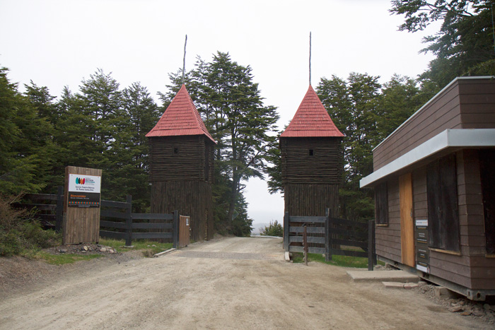
_MG_6447-fuerte-bulnes

Entrance to Fuerte Bulnes – we were just too late to enter

If we had been able to enter we would have seen the reconstructed fort which looks like this:
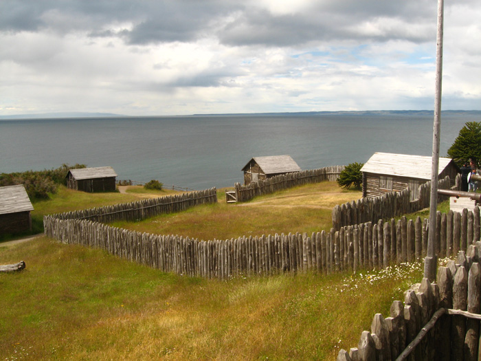
The reconstructed fort - picture from wikipedia commons

The reconstructed fort – photo from wikipedia commons

Just south of here is Cape Froward, the southernmost point of continental South America. We didn’t attempt to go there.

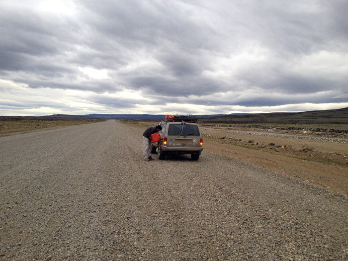
Filling with petrol at the [closed] gates of Puerto Hambre

Filling with petrol at the [closed] gates of Puerto Hambre

From Fort Bulnes we drove the couple of kilometres to Port Famine, originally founded by Sarmiento de Gamboa in 1584 and renamed by Thomas Cavendish, who landed there in 1587. We were too late for entry there too, but took advantage to use one of our jerry cans as petrol is very expensive in Chile.
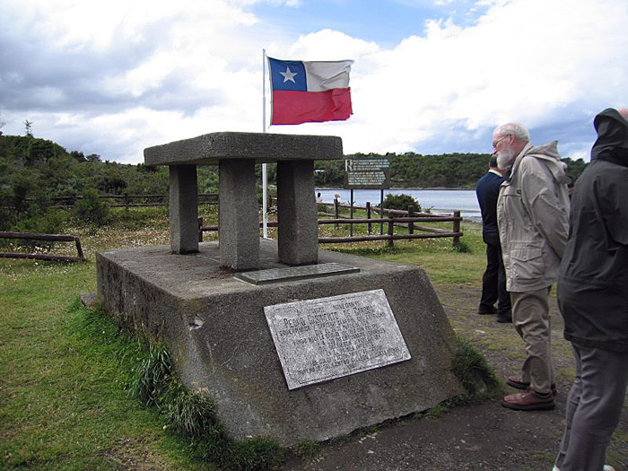
Monument at Port Famine - photo from http://www.pbase.com

Monument at Port Famine – photo from http://www.pbase.com

What we missed was a monument to the early settlers and a few signs of their miserable existence, but we were rather more concerned with our own miserable existence as we nearly froze to death with all the metallic contact involved in getting the petrol off the roof and into the car in the bitter cold wind.
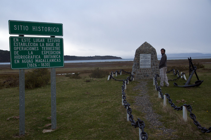
Monument to Philip Parker KIng, commander of HMS Adventure which accompanied HMS Beagle, and spent five years surveying the complex coasts around the Strait of Magellan

Monument to Philip Parker King, commander of HMS Adventure which accompanied HMS Beagle, and spent five years surveying the complex coasts around the Strait of Magellan

We did see a couple of small graveyards with white wooden crosses surrounded by white picket fences, the resting places of settlers over the ages. Also a monument to famous hydrographer Philip Parker King, who surveyed so much of the coastal waters of Australia and Patagonia.
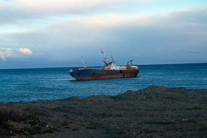
One of many wrecked vessels we saw on the coast up to Punta Arenas

One of many wrecked vessels we saw on the coast up to Punta Arenas

So we drove back up to Punta Arenas, passing a number of semi-sunken and abandoned ships on or close by the shoreline as we looked for somewhere to eat and sleep.
RN40 south, day 8

Day: 8
Trajectory: In and around El Calafate, incl. Perito Moreno Glaciar.

Distance covered:   150 km (approx. 20 on foot)


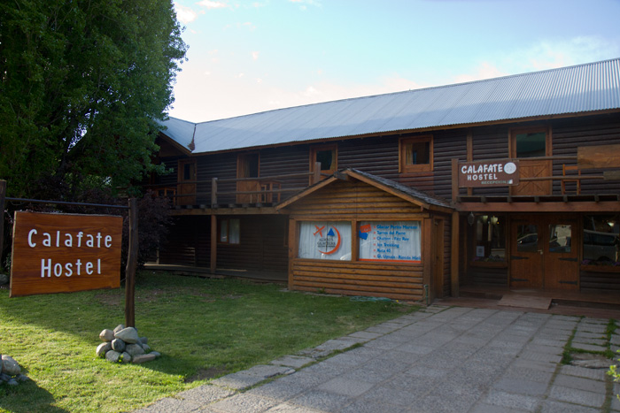
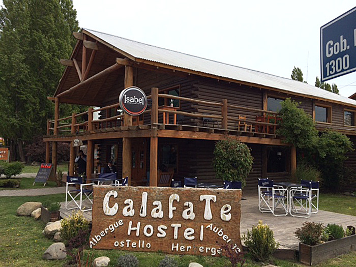
Our hostel in El Calafate

Our hostel in El Calafate

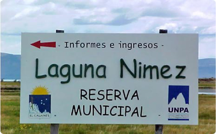
We decided to stay another night in Calafate. Tiso slept in a bit and I got up at 7 am to visit the Nimez Bird reserve, an excellent birding site and as good as the sites I am familiar with back in the UK.

This was a superb birding site - highly recommended

This was a superb birding site – highly recommended

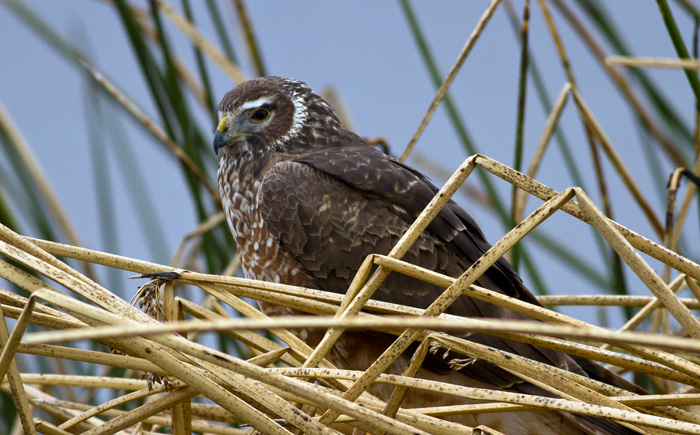
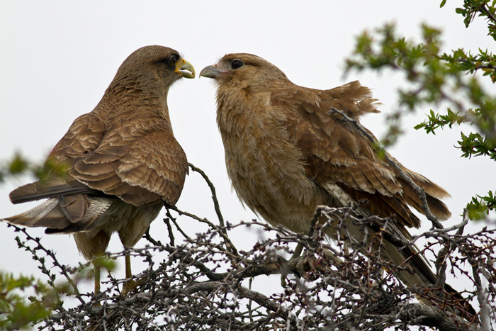
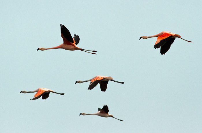
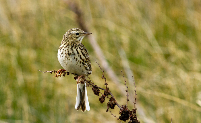
This is not a birding blog, but I’ll just show one or two of the birds I saw that particularly pleased me.

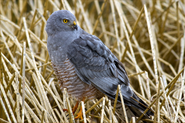
Cinereous Harrier (male)

Cinereous Harrier (male)

and Cinereous Harrier (female)

and Cinereous Harrier (female)

a couple of chimangos

a couple of chimangos

some flamingos flying by

some flamingos flying by

and a pretty little pipit

and a pretty little pipit

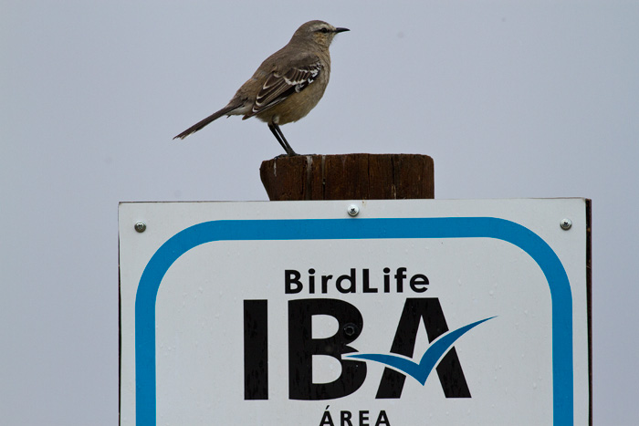
An excellent morning’s birding in a superb IBA. To sum up with one picture:

a final picture that says it all ...

a final picture that says it all …

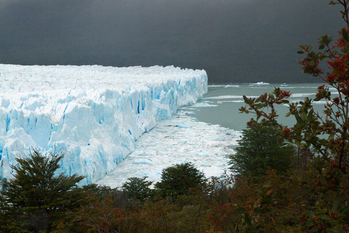
We had lunch, and set off for the Perito Moreno Glaciar, some 80 km from Calafate. This was to be very different from the Viedma Glaciar of the previous day, and as we were arriving late in the afternoon we were able to drive right up to the stairways.

A long view of the glacier face

A long view of the glacier face

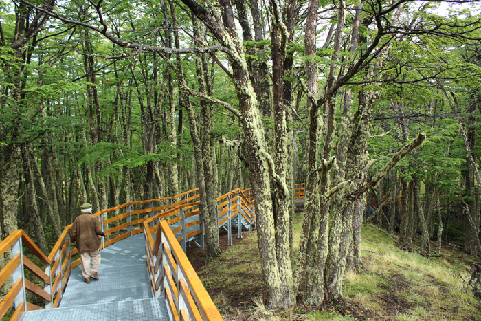
The views were excellent, and the site extremely well designed with a series of walkways that covered a huge area and offered viewing from many different heights and angles. The walkways wound through woodland and were a pleasure in themselves:

The glacier has an extensive system of observation walkways

The glacier has an extensive system of observation walkways that go right down …

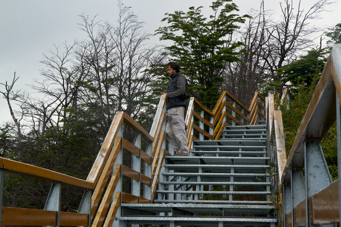
... and back up again

… and back up again

So well designed are the walkways and so well spaced the steps and flights that coming back up was no effort at all, even in the driving rain as it was time to leave.

The glacier from another angle

The glacier from another angle

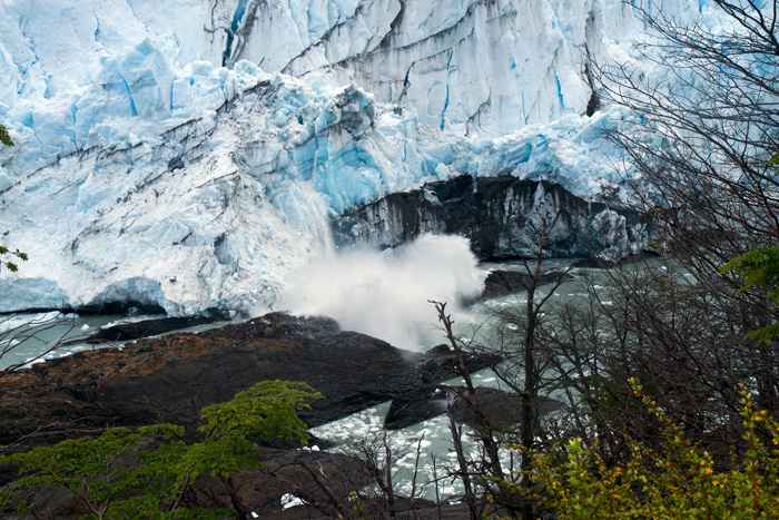
The glacier can be viewed from a number of different positions. We could hear the constant sounds of chunks breaking off and falling into the water and we were lucky enough to see one substantial piece fall.

Large section of ice breaking away and falling into the water

Large section of ice breaking away and falling into the water

Our visit to the glacier over we drove back to the hostel for a welcome evening meal and to plan the following day. More in tomorrow’s blog.


RN40 south, day 7

Day: 7
Trajectory: El Chalten – El Calafate (via Viedma Glaciar)

Distance covered:   214 km


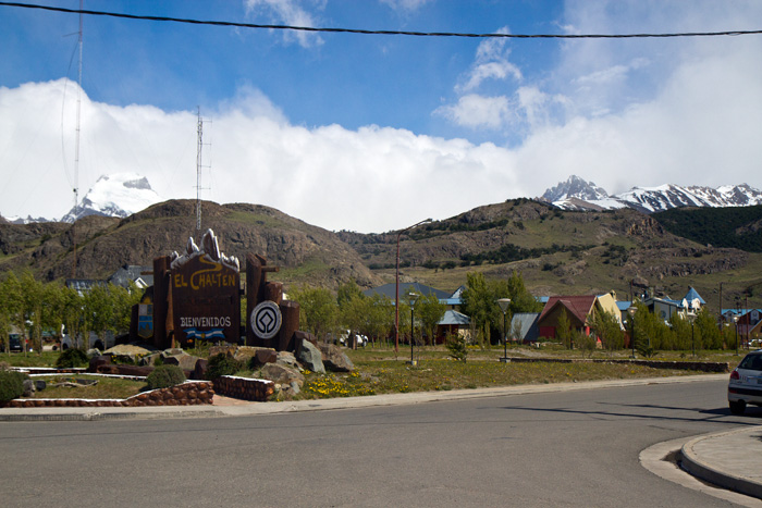
General view of Chalten

General view of El Chalten

We woke up refreshed, and for once with nothing car related to prioritise. El Chalten is one of the world’s great trekking towns, full of backpackers and hostels. The day was unfortunately rather overcast, and we were unable to get clear views of Cerros Torre and Fitzroy, but this is what they would have looked like:

This is what we would have seen if the skies had been clear (photo from Internet)

This is what we would have seen if the skies had been clear (photo from Internet)

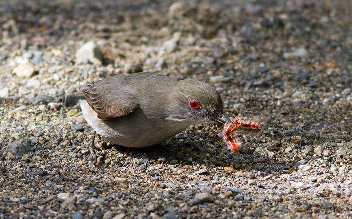
After our long walk a couple of days earlier neither of us was really into much walking so for our morning activity we drove a little way out of town to visit an attractive waterfall. The road there was through woodland with great views of the river winding its way through the valley. One waterfall looks much like another when you have a 400mm lens on your camera so instead I’ll post a picture of a diucon finch that sat in our path playing with his midday meal.

Diucon Finch. far too busy with his lunch to pay us much attention

Diucon Finch. far too busy with his lunch to pay us much attention

We couldn’t get any money in Chalten. There is no bank and the only cash machine was out of service. To make things worse most places won’t take plastic, so this, plus the weather, decided us to make that night for El Calafate. But first some lunch – a guy with a jeep like ours whom we met in the bus station steered us to a place that did take cards and we filled our stomachs there.

Lunch, in a plastic friendly bar

Lunch, in a plastic-friendly bar

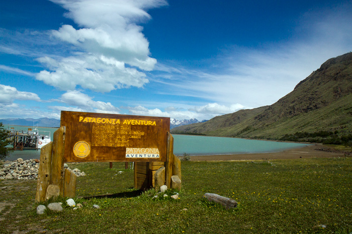
Before leaving El Chalten we decided to visit the Viedma Glaciar as the weather over the lake in that direction looked a little more encouraging, so we made our way out of town to the port where we could take the catamaran up to the Glaciar. This would be a first for me, and I was quite excited; the sign awaiting us when we arrived summed up nicely how I was feeling – this was indeed another part of our Patagonian Adventure.

The sign at the port summed up nicely what we were feeling about our journey

The sign at the port summed up nicely what we were feeling about our journey

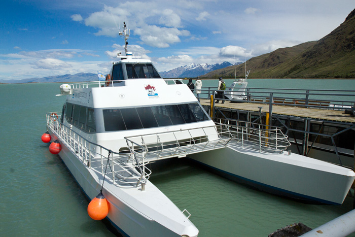
We got there in good time, fingers crossed that the wind would  not change direction as that would cancel the trip. We were lucky and were soon boarding the catamaran.

The catamaran that took us to Viedma Glaciar

The catamaran that took us to Viedma Glaciar

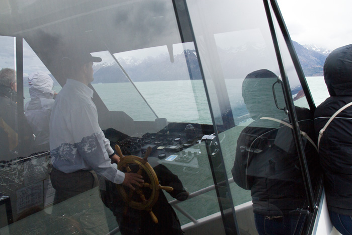
It was a pleasant sail, although it became colder and colder as we approached the glacier.

Sailing glaciarwards as the wind got colder ...

Sailing glaciarwards as the wind got colder …

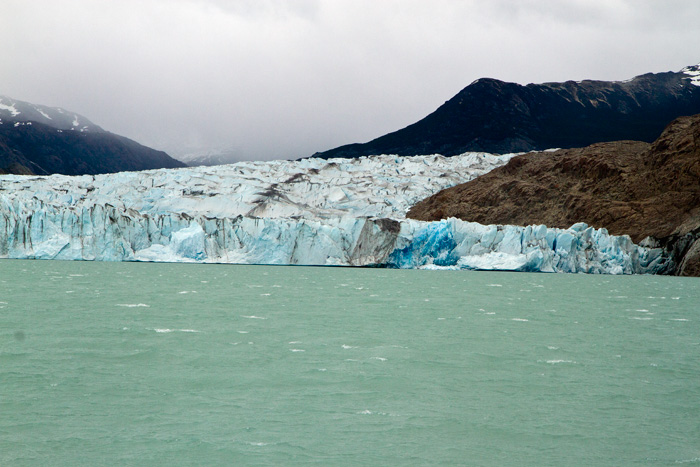
Finally we arrived within some 800 metres of the face of the glacier. The view was splendid, but it was tough staying on deck to take pictures. We persisted, and here is a view from fairly close.

800 metres from the face of the glaciar

Some 800 metres from the face of the glacier, shot with a wide-angle lens

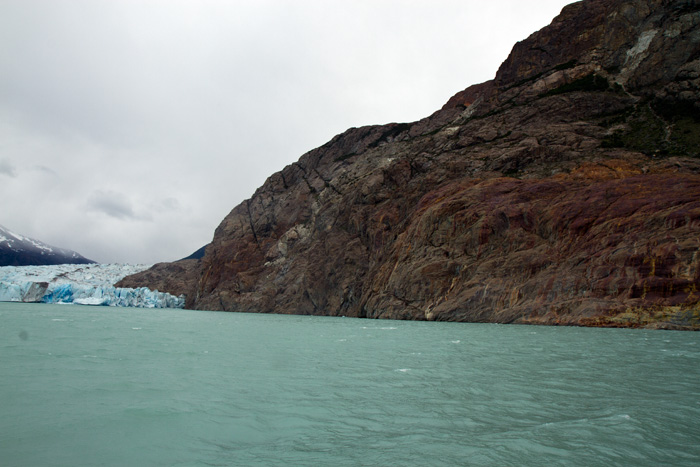
In fact, for those of us who could brave the elements, it was a wonderful fusion of rock, ice, water, cloud and sky, …

All the elements (except fire) in fusion

All the elements (except fire) in fusion

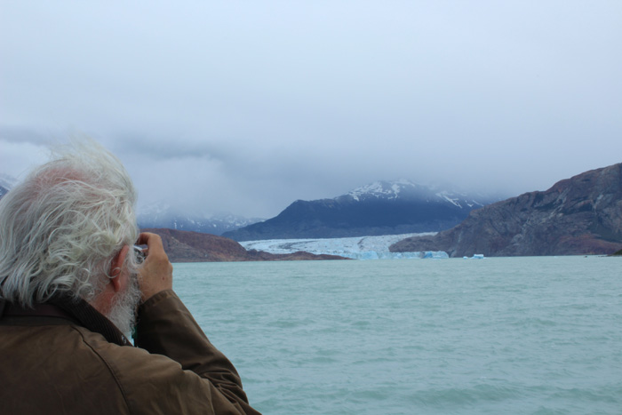
… with the more intrepid on deck snapping away … for once hatless, because of the wind.

Your photographer braving the cold

Your photographer braving the cold

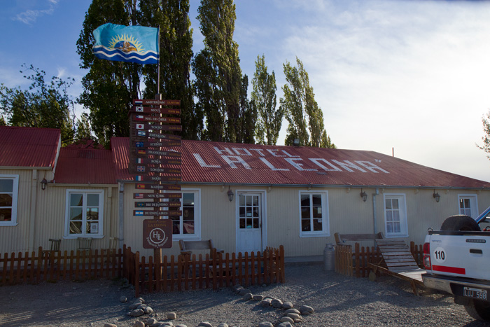
All good things come to an end, and we got back to the jetty and set off for the shortish drive to El Calafate. It was a straightforward drive, but we did stop off at the famous La Leona Hotel; famous because Butch Cassidy and the Sundance Kid holed up there for a month after robbing a bank in Río Gallegos. Maybe. These stories grow in the telling, and they may just have spent a night there, and it really doesn’t matter …

La Leona Hotel, another putative Butch Cassidy connection

La Leona Hotel, another putative Butch Cassidy connection

We also noticed as we drove through wide glacial valleys that there were quite a few boulders deposited by the glaciers and now sitting rather incongruously in the middle of nowhere. I remember learning about this at school in geography lessons, and it was nice to see them in the flesh, so to speak.

Glacial erratic - a reminder of when much of Patagonia was covered in glaciers

Glacial erratic – a reminder of when much of Patagonia was covered in glaciers

We arrived in El Calafate in good time and after first taking the wrong road and finding ourselves in a very unprepossessing area we eventually got into the town centre and found a great hostel almost immediately.

Hostal and restaurant in El Calafate

Hostal and restaurant in El Calafate

Calafate is another trekking town, although much bigger than Chalten and is a thriving town in its own right. We had a good meal, and off to bed, planning to visit Chile’s Paine Park the next day.

RN40 south, day 6

Day: 6
Trajectory: Los Antiguos – Perito Moreno – Bajo Caracoles – Gobernador Gregores – Tres Lagos – El Chalten

Distance covered:   711 km


Today's journey, a long haul

Today’s journey, a long haul

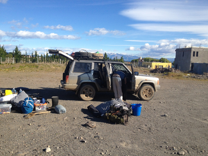
A long drive today, in an attempt to make up for lost time faffing about in the menuco, and a little longer than it should have been owing to a map misunderstanding and nonexistent road signage. But first we had to get the car sorted. This involved cleaning the mud out of the inside; repacking; washing the extra mud off the wheels and underneath the car to restore some sense of balance, etc.

The Jeep had to be cleaned thoroughly inside as it was full of mud, so everything had to come out and be repacked

The Jeep had to be cleaned thoroughly inside as it was full of mud, so everything had to come out and be repacked

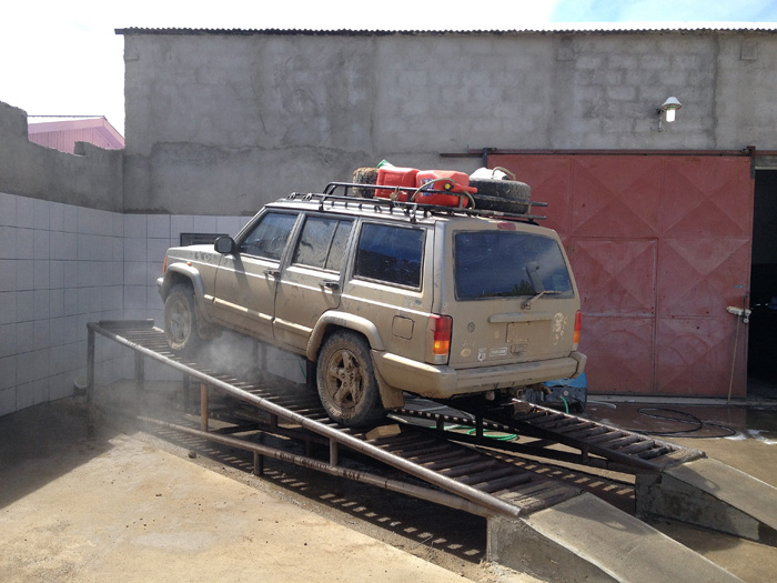
Then we had to get the car up on a ramp and get all the mud hosed off the wheels, etc.

Then we had to get the car up on a ramp and get all the mud hosed off the wheels, etc.

We paid a quick visit to a mechanic to check everything was ok and then we were on our way south again, a little behind schedule but in great spirits.

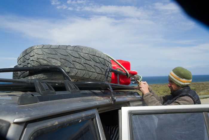
Checking everything was strapped down tight

Checking everything was strapped down tight

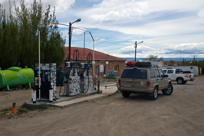
We made good progress as we drove south, passing through some small towns and even smaller stops. One was Bajo Caracoles, a ten house village with a hotel and the only fuel for hundreds of kilometres in every direction. And often it didn’t have any fuel at all, but this was not such a huge problem as there was a hotel (of sorts) there where the traveller can wait until a tanker arrives. We had to wait an hour or so for the owner to arrive as he was having lunch, but we passed the time talking to a Colombian biker and some guys heading south to fish for salmon.

The combined petrol station and hotel at Bajo Caracoles

The combined petrol station and hotel at Bajo Caracoles

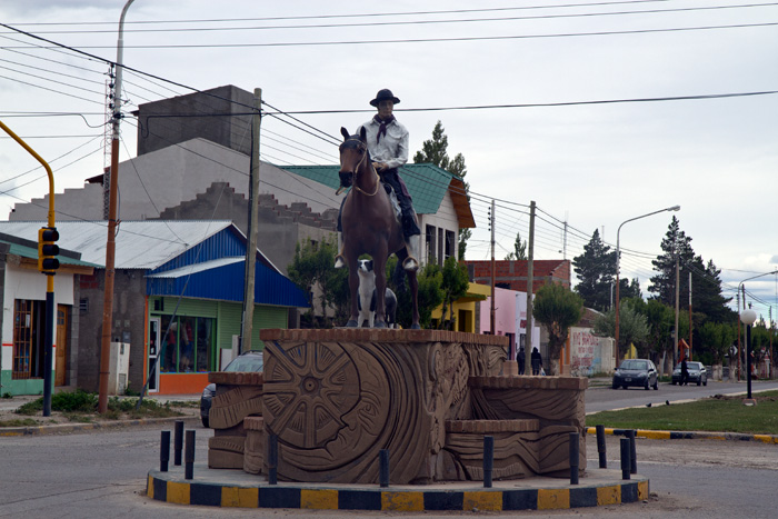
We passed through Gobernador Gregores too. We shouldn’t have, but we somehow missed a turn and paid for it with some extra kilometres. It seemed a tidy place, with a big gaucho statue in the middle of the main drag – perhaps Gobernador Gregores himself.

Is this the onetime Governor of  Santa Cruz province, Juan Manuel Gregores?

Is this the onetime Governor of Santa Cruz province, Juan Manuel Gregores?

All in all, compared with the previous two days, a quiet journey, only disturbed by getting a little lost in Gobernador Gregores, and punctuated with road kill and road fill.

Roadkill - a mulita, hit by a passing vehicle

The roadkill – a mulita, hit by a passing vehicle (not us!)

.. and the roadkill - we were glad that we were carrying the extra jerry cans

.. and the road fill – we were glad that we were carrying the extra jerry cans

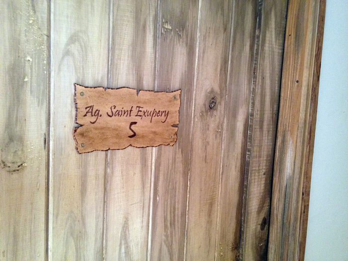
We drove into El Chalten late at night, and more by luck than management parked outside a nice bistro type restaurant next to a trekkers’ hostel that had space. Our luck was still holding out, it seemed. We went to sleep tired but happy, in a room called St Exupery – which amused me as I had been reading Vol de Nuit only a few weeks ago in preparation for the journey.

Our room in the Hostel at El Chalten

Our room in the Hostel at El Chalten

El Chalten was a lovely little town – but more about that in tomorrow’s blog post.

RN40 south, day 5

Day: 5
Trajectory: Los Menucos – Los Antiguos

Distance covered:   286 km (approx. 20 on foot)


If yesterday was an unlucky one, today was one of the most incredible luck. But let’s take things in order. Very few pictures today – we really were not very concentrated on photography.

We spent a reasonably comfortable night sleeping in the car, although with the bottom of the metal box we were sleeping in in contact with the ground it was a bit cold. Just how cold it was I realised when I got up at about 3 am to answer a call of nature, but at least the slushy mud had turned to hard ice which was rather more pleasant to negotiate on foot than the slushy mud of a few hours earlier.

We prioritised: first get ourselves to safety; second rescue the jeep; third get any necessary repairs done.

We started walking at about 5.30 am, when the light was sufficient. The surface was mixed – ice, rock and (as it thawed) mud, but not too bad. As a safety decision we made a solemn decision to keep to the road (no short cuts) and just walked. And walked. We weren’t exactly sure how long it would take to get to ‘civilisation’ (whatever that might mean) and neither of us was in great shape for a long trek but the survival instinct took over. We aimed to cover 4 km each hour and pretty much managed it most of the time, resting occasionally and still munching on the bread from the previous day.

We carried water, chocolate, tinned meat and dry biscuits and enough clothes to stay warm and dry. We had to leave sleeping gear in the jeep as we would in any case not have survived a night in the open and we were confident of reaching the border post before nightfall. The only uncertainty was the weather but it looked good. And we had to get out of there.

Continuing our journey on foot .. at approx. 2,300 metres in the Cordillera

Continuing our journey on foot .. at approx. 2,300 metres in the Cordillera

We started walking where we had had to turn back the previous afternoon in the Jeep. We didn’t realise it at the time but we were going to complete the R41, by hook and by crook, by car and by foot – undoubtedly the only people to do so for a while. It didn’t take too long to get into a rhythm and at no time were we ever seriously cold although layers of clothes came off and back on again as hot sun and cold wind alternated. We saw that there was a lot more snow on the road, and that no vehicle was going to get through. It was in fact a privileged experience to walk in such a remote spot – one that not so many people do, though we were perhaps not in the best frame of mind to appreciate it.
The map above shows: 1. Los Antiguos; 2. approximately where we broke down; 3. the frontier post we were heading for; 4. where we met our guardian angels. The red arrows show the drive back to Los Antiguos.

The map above shows: 1. Los Antiguos; 2. approximately where we broke down; 3. the frontier post we were heading for; 4. where we met our guardian angels. The red arrows show the drive back to Los Antiguos.

In time we got tired, and in more time we got tireder but finally we could see the frontier post in the distance. It was still a few kilometres away but gave us the hope we needed and the security that we would be ok. A few minutes later a miracle occurred – a car was approaching us, attempting to do the same journey we had failed to do by car but in the obvious direction. We stopped the car and explained the situation and that they would be unable to get to Los Antiguos on the R41.

They (Augusto and Graciela) offered us a lift in their car all the way to Los Antiguos the long way round, one which we were thinking would take us several days to sort and with the enormous advantage that the Jeep could be rescued from Los Antiguos. They gave us a picnic lunch, drove us right up to a comfortable hotel and by about five in the afternoon we were safe, dry, warm and with only the car to worry about. The luck that we had with this couple was incalculable, and we rewarded them by sleeping (and snoring) in the back of their Renault Duster. As small recompense I offered them dinner in Los Antiguos that evening – a symbolic gesture that went no way at all towards the gratitude we owed them.
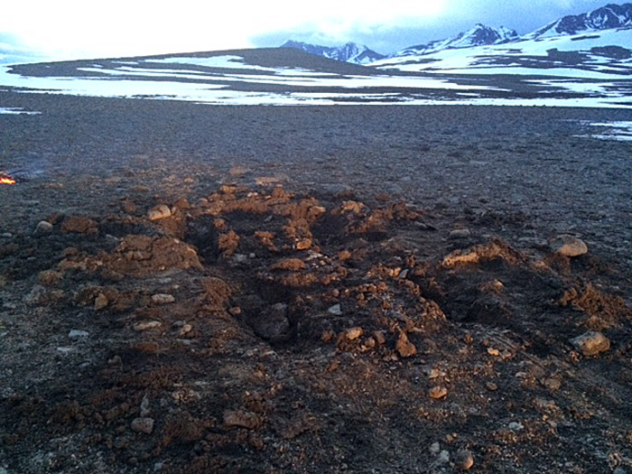
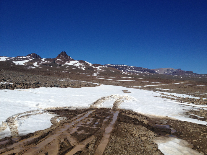
A memory of where the Jeep had been ....

A memory of where the Jeep had been ….

On arrival in Los Antiguos and from unknown hidden depths Tiso summoned immense inner strength and tackled the problem of the Jeep left high up in the Cordillera. We found out there was a volunteer mountain rescue force, the Grupo Halcón, and two volunteers agreed to go up the 76 kms back to menuco immediately to rescue the car, Tiso accompanying them. They collected firewood on the way and once there built a fire to combat the cold and were able to get the car out and back down to the hotel by about 11 pm that night. Tiso took a final photograph of the spot where I had envisioned the Jeep might be staying quite a while. I in the meantime had the onerous task of inviting our rescuers to dinner in the hotel; delicious Patagonian lamb.

The outshot of all this was that we lost two days of our original itinerary, which we were later to modify. We shared a life experience which we will keep for a long time. The Jeep turned out to be unharmed if a little dirty, and we would be able to continue our journey the next day. We slept well. And if Augusto and Graciela ever read this blog, out heartfelt thanks go to you still.

RN40 south, day 4

Day: 4
Trajectory:  Perito Moreno – Los Antiguos – Los menucos

Distance covered:   123 km


This is a day that did not go as planned. It started well and finished badly. We had been looking for an adventure, and we got one. Be careful what you wish for, ….

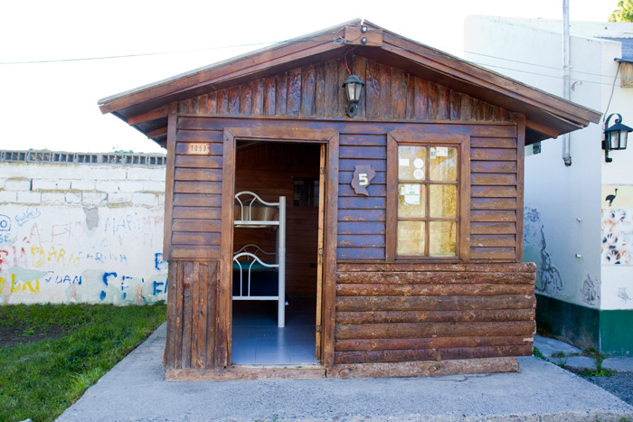
Cabin at Perito Moreno Municipal camping site

Cabin at Perito Moreno Municipal camping site

We had spent the night at the municipal camping site in Perito Moreno; no heating but we had sleeping bags. No wifi either, a pattern that would repeat itself for the next few days. But it was a good night, we slept well and we left in great spirits.

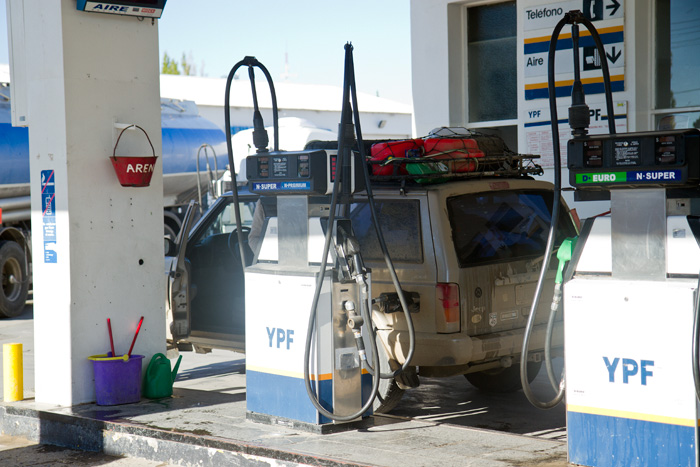
Fuelling in Perito Moreno

Fuelling in Perito Moreno

We filled up with fuel in Perito Moreno and drove off on what we had planned to be a side trip to visit Los Antiguos, a pretty town to the west. Once there we decided that rather than drive back to Perito Moreno we would drive over the R41, a mountain road that would link up with our day’s destination, Bajo Caracoles. We had been told by our friend Gonzalo that this was a spectacular road, and indeed it turned out to be so.

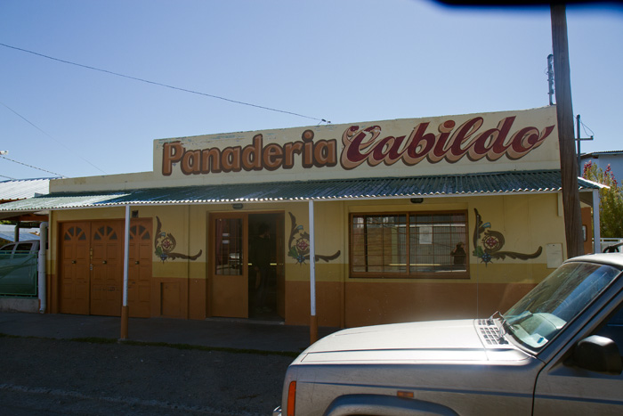
Bakery in Los Antiguos, and dispenser of advice and wisdom

Bakery in Los Antiguos, and dispenser of advice and wisdom

This decision was supported by the lady in the panaderia in Los Antiguos who told us we would be likely to see Macá Tobiano (Hooded Grebe) in lagoons alongside the road and that it was a straightforward drive, a view supported by a woman in the Aduana at the Los Antiguos frontier.
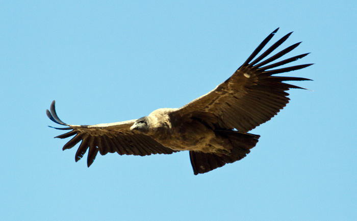
Juvenile condor, one of some half dozen on the R4i from Los Antiguos

Juvenile condor in its brown plumage, one of some half dozen on the R41 from Los Antiguos

So we set off on the R41, and indeed it was a beautiful, spectacular drive. We didn’t see any Hooded Grebes (it was always too good to be true) but did see a lot of birds, including  steamer ducks and half a dozen juvenile condors who circled us with interest. They were accompanied by a single adult female, and seemed to be learning how to fly, taking short trips and returning to land. We were of no concern whatsoever to them and sat for some twenty minutes enjoying the spectacle.

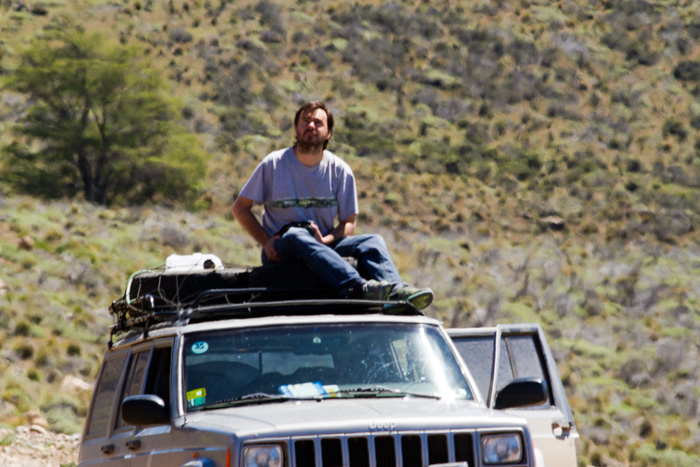
Tiso enjoying the condor show

Tiso enjoying the condor show

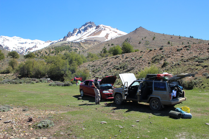
Further along the road we came across a car with a family camping in a valley who flagged us down. They were suffering from a flat battery and had been there for three days in which time no traffic had gone by.

Playing good samaritans ...

Playing good samaritans …

We found out later that this was because the road was closed, but traffic is so light in this part of the world anyway that it sounded normal to us. We were able to help them, and continued on our way.

Finally snow blocked the road completely.

Finally snow blocked the road completely.

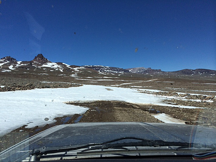
The road continued to climb way above the treeline until we reached the top of the world, or at least it felt like it, some 2,300 metres high. We continued, until finally there was simply too much snow for us to drive through. The combined depth of snow and soft mud beneath was too much for Silver the Jeep to handle.

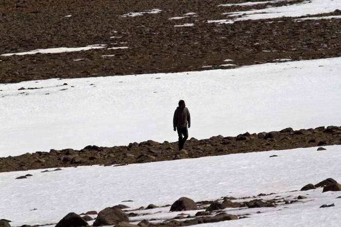
Tiso surveys the terrain

Tiso surveys the terrain

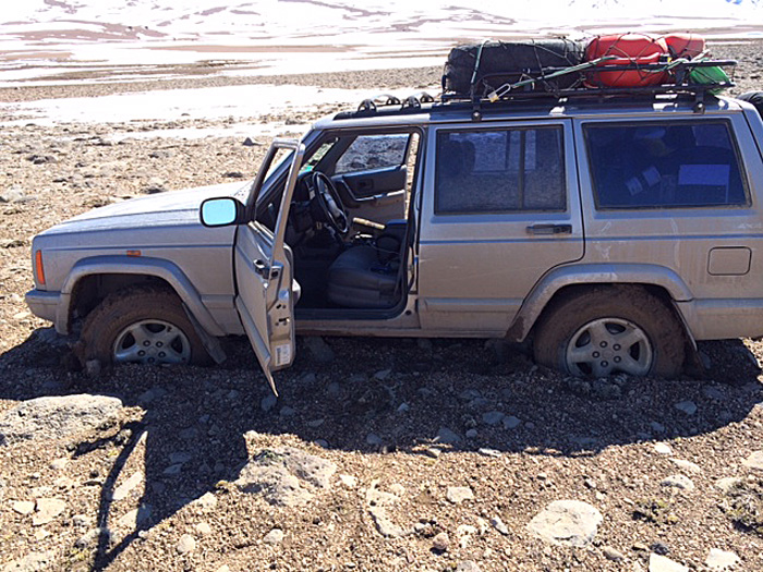
Tis went off to look at the rocky land to see if we could skirt the snowfall by driving overland. He found a route that looked firm and where the rocks were of a reasonable size and we set off cross country, trusting in the Jeep to get us through. It would probably have worked, but what we couldn’t see was that we were crossing an underground stream and the weight of the fully laden jeep was just too much. The jeep and its inhabitants were going nowhere.

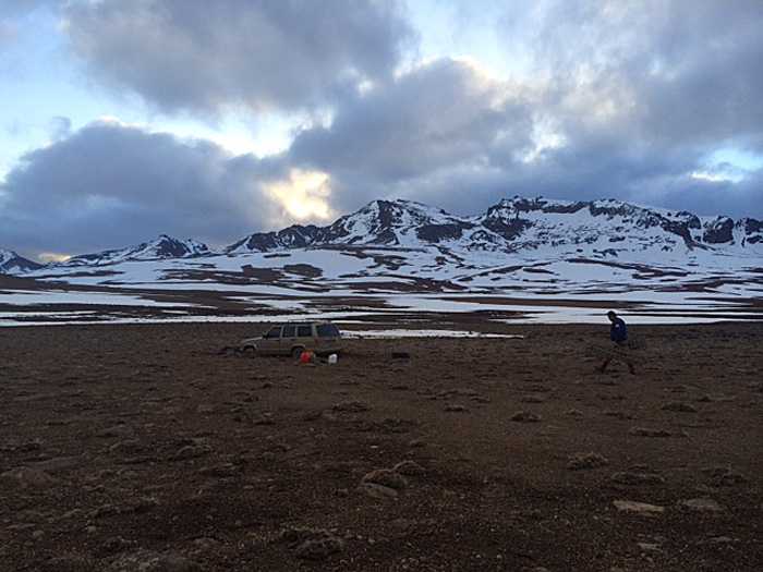
Heavy jeep + soft ground = immobility

Heavy jeep + soft ground = immobility

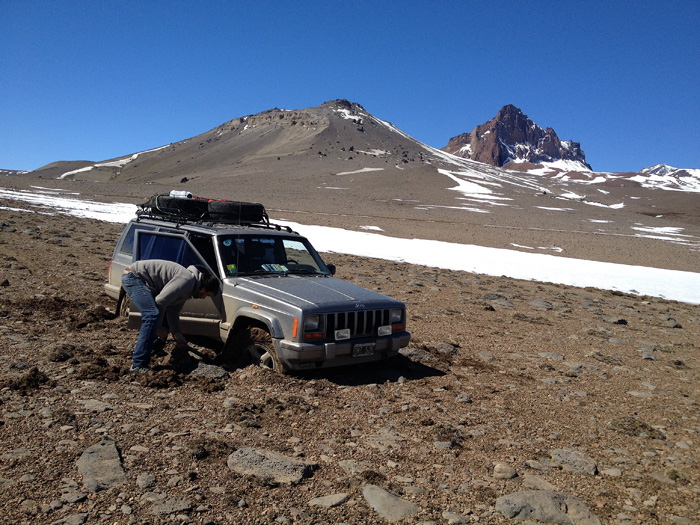
Our spirits were good, but our attempts to dig out were useless, the Jeep continued to sink until its floor was resting on the ground and there was nothing we could do to get it onto solid ground.

Tiso valiantly tries to dig us out, to no avail

Tiso valiantly tries to dig us out, to no avail

We evaluated our position. It was about 6 pm, and we calculated that there was a border post which would probably be manned some 25 kms away. There was clearly insufficient time or light to walk that night so we agreed we would spend the night in the car and set off at first light. We had the proper equipment for an emergency like this, but were also aware that a lot depended on the weather – it can change very quickly in the Andes, and walking through a snowstorm the following day was not a prospect to be welcomed.

Probably not the ideal movie for our situation

Probably not the ideal movie for our situation

As night fell we munched on the bread we had bought in Los Antiguos and watched one of the three movies I had on my iPad, Donnie Darko. The film itself is surreal enough, but watching it stranded in the Cordillera in subzero temperatures lent it an extra sense of the bizarre. The message was not too encouraging either, but neither of us commented on it.

Night falls in the Cordillera as we plan our walk to safety the following day

Night falls in the Cordillera as we plan our walk to safety the following day

Obviously we did get away, and I’ll explain how in the next day’s blog.