RN40 south, day 6

Day: 6
Trajectory: Los Antiguos – Perito Moreno – Bajo Caracoles – Gobernador Gregores – Tres Lagos – El Chalten

Distance covered:   711 km


Today's journey, a long haul

Today’s journey, a long haul

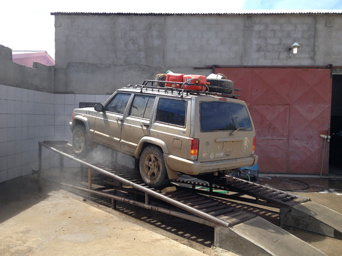
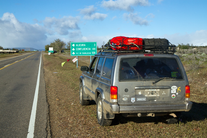
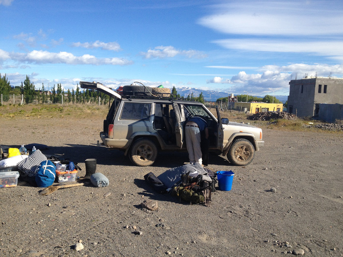
A long drive today, in an attempt to make up for lost time faffing about in the menuco, and a little longer than it should have been owing to a map misunderstanding and nonexistent road signage. But first we had to get the car sorted. This involved cleaning the mud out of the inside; repacking; washing the extra mud off the wheels and underneath the car to restore some sense of balance, etc.

The Jeep had to be cleaned thoroughly inside as it was full of mud, so everything had to come out and be repacked

The Jeep had to be cleaned thoroughly inside as it was full of mud, so everything had to come out and be repacked

Then we had to get the car up on a ramp and get all the mud hosed off the wheels, etc.

Then we had to get the car up on a ramp and get all the mud hosed off the wheels, etc.

We paid a quick visit to a mechanic to check everything was ok and then we were on our way south again, a little behind schedule but in great spirits.

Checking everything was strapped down tight

Checking everything was strapped down tight

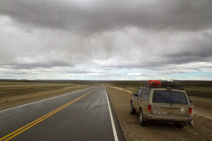
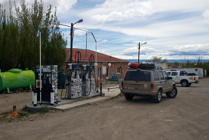
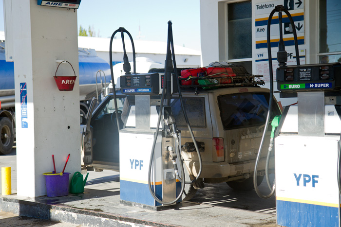
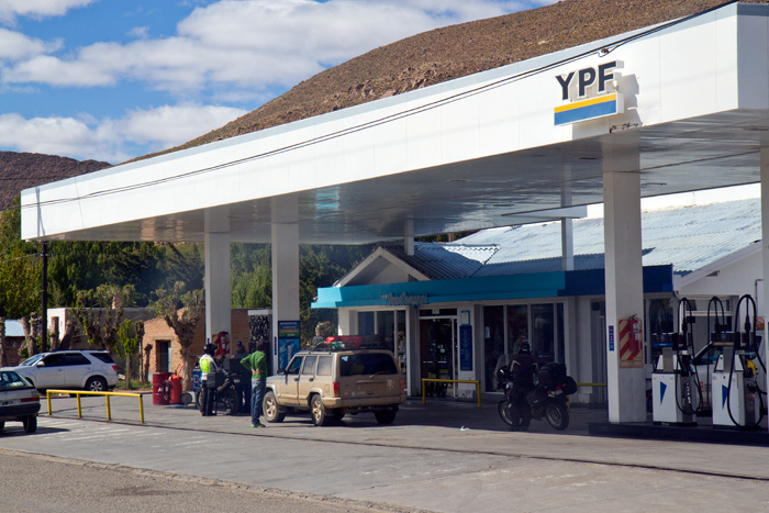
We made good progress as we drove south, passing through some small towns and even smaller stops. One was Bajo Caracoles, a ten house village with a hotel and the only fuel for hundreds of kilometres in every direction. And often it didn’t have any fuel at all, but this was not such a huge problem as there was a hotel (of sorts) there where the traveller can wait until a tanker arrives. We had to wait an hour or so for the owner to arrive as he was having lunch, but we passed the time talking to a Colombian biker and some guys heading south to fish for salmon.

The combined petrol station and hotel at Bajo Caracoles

The combined petrol station and hotel at Bajo Caracoles

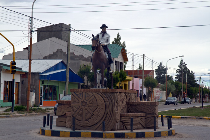
We passed through Gobernador Gregores too. We shouldn’t have, but we somehow missed a turn and paid for it with some extra kilometres. It seemed a tidy place, with a big gaucho statue in the middle of the main drag – perhaps Gobernador Gregores himself.

Is this the onetime Governor of  Santa Cruz province, Juan Manuel Gregores?

Is this the onetime Governor of Santa Cruz province, Juan Manuel Gregores?

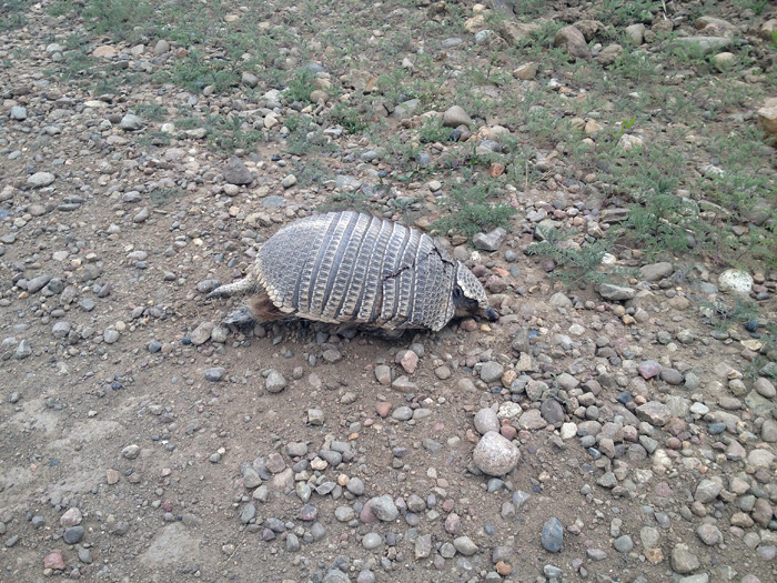
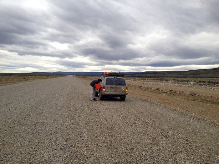
All in all, compared with the previous two days, a quiet journey, only disturbed by getting a little lost in Gobernador Gregores, and punctuated with road kill and road fill.

Roadkill - a mulita, hit by a passing vehicle

The roadkill – a mulita, hit by a passing vehicle (not us!)

.. and the roadkill - we were glad that we were carrying the extra jerry cans

.. and the road fill – we were glad that we were carrying the extra jerry cans

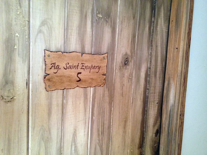
We drove into El Chalten late at night, and more by luck than management parked outside a nice bistro type restaurant next to a trekkers’ hostel that had space. Our luck was still holding out, it seemed. We went to sleep tired but happy, in a room called St Exupery – which amused me as I had been reading Vol de Nuit only a few weeks ago in preparation for the journey.

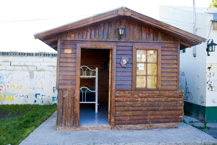
Our room in the Hostel at El Chalten

Our room in the Hostel at El Chalten

El Chalten was a lovely little town – but more about that in tomorrow’s blog post.

RN40 south, day 5

Day: 5
Trajectory: Los Menucos – Los Antiguos

Distance covered:   286 km (approx. 20 on foot)


If yesterday was an unlucky one, today was one of the most incredible luck. But let’s take things in order. Very few pictures today – we really were not very concentrated on photography.

We spent a reasonably comfortable night sleeping in the car, although with the bottom of the metal box we were sleeping in in contact with the ground it was a bit cold. Just how cold it was I realised when I got up at about 3 am to answer a call of nature, but at least the slushy mud had turned to hard ice which was rather more pleasant to negotiate on foot than the slushy mud of a few hours earlier.

We prioritised: first get ourselves to safety; second rescue the jeep; third get any necessary repairs done.

We started walking at about 5.30 am, when the light was sufficient. The surface was mixed – ice, rock and (as it thawed) mud, but not too bad. As a safety decision we made a solemn decision to keep to the road (no short cuts) and just walked. And walked. We weren’t exactly sure how long it would take to get to ‘civilisation’ (whatever that might mean) and neither of us was in great shape for a long trek but the survival instinct took over. We aimed to cover 4 km each hour and pretty much managed it most of the time, resting occasionally and still munching on the bread from the previous day.

We carried water, chocolate, tinned meat and dry biscuits and enough clothes to stay warm and dry. We had to leave sleeping gear in the jeep as we would in any case not have survived a night in the open and we were confident of reaching the border post before nightfall. The only uncertainty was the weather but it looked good. And we had to get out of there.

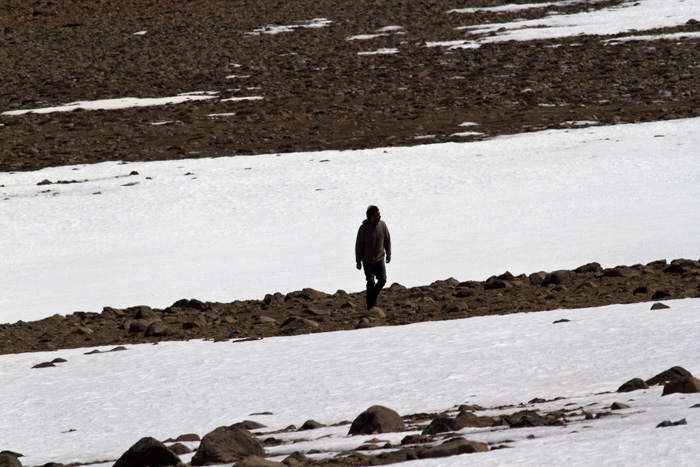
Continuing our journey on foot .. at approx. 2,300 metres in the Cordillera

Continuing our journey on foot .. at approx. 2,300 metres in the Cordillera

We started walking where we had had to turn back the previous afternoon in the Jeep. We didn’t realise it at the time but we were going to complete the R41, by hook and by crook, by car and by foot – undoubtedly the only people to do so for a while. It didn’t take too long to get into a rhythm and at no time were we ever seriously cold although layers of clothes came off and back on again as hot sun and cold wind alternated. We saw that there was a lot more snow on the road, and that no vehicle was going to get through. It was in fact a privileged experience to walk in such a remote spot – one that not so many people do, though we were perhaps not in the best frame of mind to appreciate it.

The map above shows: 1. Los Antiguos; 2. approximately where we broke down; 3. the frontier post we were heading for; 4. where we met our guardian angels. The red arrows show the drive back to Los Antiguos.

The map above shows: 1. Los Antiguos; 2. approximately where we broke down; 3. the frontier post we were heading for; 4. where we met our guardian angels. The red arrows show the drive back to Los Antiguos.

In time we got tired, and in more time we got tireder but finally we could see the frontier post in the distance. It was still a few kilometres away but gave us the hope we needed and the security that we would be ok. A few minutes later a miracle occurred – a car was approaching us, attempting to do the same journey we had failed to do by car but in the obvious direction. We stopped the car and explained the situation and that they would be unable to get to Los Antiguos on the R41.

They (Augusto and Graciela) offered us a lift in their car all the way to Los Antiguos the long way round, one which we were thinking would take us several days to sort and with the enormous advantage that the Jeep could be rescued from Los Antiguos. They gave us a picnic lunch, drove us right up to a comfortable hotel and by about five in the afternoon we were safe, dry, warm and with only the car to worry about. The luck that we had with this couple was incalculable, and we rewarded them by sleeping (and snoring) in the back of their Renault Duster. As small recompense I offered them dinner in Los Antiguos that evening – a symbolic gesture that went no way at all towards the gratitude we owed them.

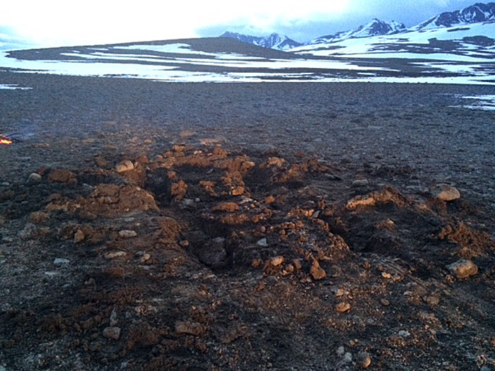
A memory of where the Jeep had been ....

A memory of where the Jeep had been ….

On arrival in Los Antiguos and from unknown hidden depths Tiso summoned immense inner strength and tackled the problem of the Jeep left high up in the Cordillera. We found out there was a volunteer mountain rescue force, the Grupo Halcón, and two volunteers agreed to go up the 76 kms back to menuco immediately to rescue the car, Tiso accompanying them. They collected firewood on the way and once there built a fire to combat the cold and were able to get the car out and back down to the hotel by about 11 pm that night. Tiso took a final photograph of the spot where I had envisioned the Jeep might be staying quite a while. I in the meantime had the onerous task of inviting our rescuers to dinner in the hotel; delicious Patagonian lamb.

The outshot of all this was that we lost two days of our original itinerary, which we were later to modify. We shared a life experience which we will keep for a long time. The Jeep turned out to be unharmed if a little dirty, and we would be able to continue our journey the next day. We slept well. And if Augusto and Graciela ever read this blog, out heartfelt thanks go to you still.

RN40 south, day 4

Day: 4
Trajectory:  Perito Moreno – Los Antiguos – Los menucos

Distance covered:   123 km


This is a day that did not go as planned. It started well and finished badly. We had been looking for an adventure, and we got one. Be careful what you wish for, ….

Cabin at Perito Moreno Municipal camping site

Cabin at Perito Moreno Municipal camping site

We had spent the night at the municipal camping site in Perito Moreno; no heating but we had sleeping bags. No wifi either, a pattern that would repeat itself for the next few days. But it was a good night, we slept well and we left in great spirits.

Fuelling in Perito Moreno

Fuelling in Perito Moreno

We filled up with fuel in Perito Moreno and drove off on what we had planned to be a side trip to visit Los Antiguos, a pretty town to the west. Once there we decided that rather than drive back to Perito Moreno we would drive over the R41, a mountain road that would link up with our day’s destination, Bajo Caracoles. We had been told by our friend Gonzalo that this was a spectacular road, and indeed it turned out to be so.

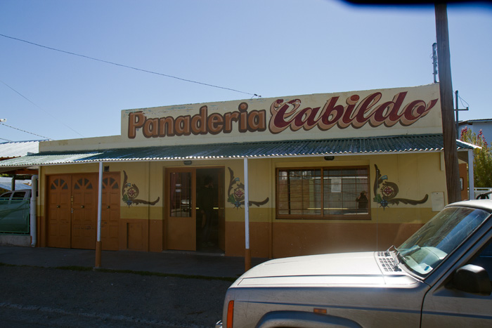
Bakery in Los Antiguos, and dispenser of advice and wisdom

Bakery in Los Antiguos, and dispenser of advice and wisdom

This decision was supported by the lady in the panaderia in Los Antiguos who told us we would be likely to see Macá Tobiano (Hooded Grebe) in lagoons alongside the road and that it was a straightforward drive, a view supported by a woman in the Aduana at the Los Antiguos frontier.

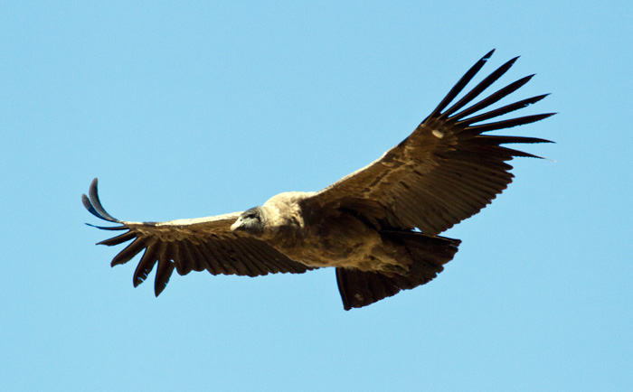
Juvenile condor, one of some half dozen on the R4i from Los Antiguos

Juvenile condor in its brown plumage, one of some half dozen on the R41 from Los Antiguos

So we set off on the R41, and indeed it was a beautiful, spectacular drive. We didn’t see any Hooded Grebes (it was always too good to be true) but did see a lot of birds, including  steamer ducks and half a dozen juvenile condors who circled us with interest. They were accompanied by a single adult female, and seemed to be learning how to fly, taking short trips and returning to land. We were of no concern whatsoever to them and sat for some twenty minutes enjoying the spectacle.

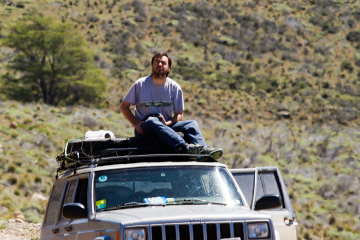
Tiso enjoying the condor show

Tiso enjoying the condor show

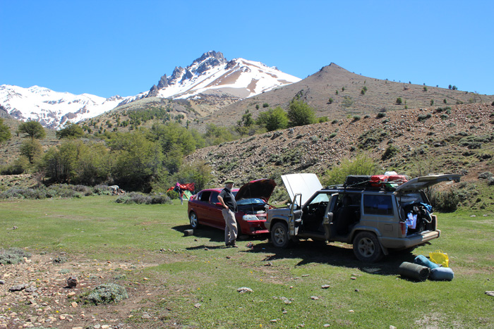
Further along the road we came across a car with a family camping in a valley who flagged us down. They were suffering from a flat battery and had been there for three days in which time no traffic had gone by.

Playing good samaritans ...

Playing good samaritans …

We found out later that this was because the road was closed, but traffic is so light in this part of the world anyway that it sounded normal to us. We were able to help them, and continued on our way.

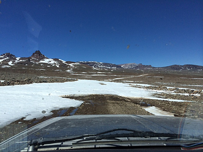
Finally snow blocked the road completely.

Finally snow blocked the road completely.

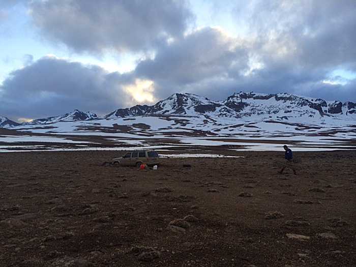
The road continued to climb way above the treeline until we reached the top of the world, or at least it felt like it, some 2,300 metres high. We continued, until finally there was simply too much snow for us to drive through. The combined depth of snow and soft mud beneath was too much for Silver the Jeep to handle.

Tiso surveys the terrain

Tiso surveys the terrain

Tis went off to look at the rocky land to see if we could skirt the snowfall by driving overland. He found a route that looked firm and where the rocks were of a reasonable size and we set off cross country, trusting in the Jeep to get us through. It would probably have worked, but what we couldn’t see was that we were crossing an underground stream and the weight of the fully laden jeep was just too much. The jeep and its inhabitants were going nowhere.

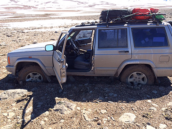
Heavy jeep + soft ground = immobility

Heavy jeep + soft ground = immobility

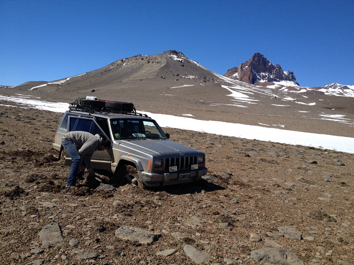
Our spirits were good, but our attempts to dig out were useless, the Jeep continued to sink until its floor was resting on the ground and there was nothing we could do to get it onto solid ground.

Tiso valiantly tries to dig us out, to no avail

Tiso valiantly tries to dig us out, to no avail

We evaluated our position. It was about 6 pm, and we calculated that there was a border post which would probably be manned some 25 kms away. There was clearly insufficient time or light to walk that night so we agreed we would spend the night in the car and set off at first light. We had the proper equipment for an emergency like this, but were also aware that a lot depended on the weather – it can change very quickly in the Andes, and walking through a snowstorm the following day was not a prospect to be welcomed.

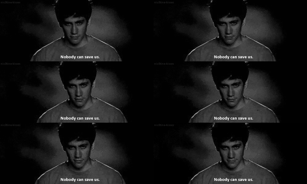
Probably not the ideal movie for our situation

Probably not the ideal movie for our situation

As night fell we munched on the bread we had bought in Los Antiguos and watched one of the three movies I had on my iPad, Donnie Darko. The film itself is surreal enough, but watching it stranded in the Cordillera in subzero temperatures lent it an extra sense of the bizarre. The message was not too encouraging either, but neither of us commented on it.

Night falls in the Cordillera as we plan our walk to safety the following day

Night falls in the Cordillera as we plan our walk to safety the following day

Obviously we did get away, and I’ll explain how in the next day’s blog.

RN40 south, day 3

Day: 3
Trajectory:  Esquel –  Gobernador Costa – Alto Río Senguerr – Río Mayo – Perito Moreno

Distance covered:   549 km

On the road again, with a few more stone chips in the windscreen

On the road again, with a few more stone chips in the windscreen

Apologies for the delay with this blog; it has been tougher finding Internet connections in Patagonia than we had thought, plus we have had one or two mishaps – to be blogged in good time, but we and Silver (the Jeep) are all fine. But a warning to people thinking (like me) of blogging their way – we have had only occasional G3 access to mobile phones, and more often the Edge or (worse) GPRS. Such wifi as we have found has simply not worked well enough to get on to the Internet. This is being sent from Punta Arenas on day 8 of our trip – who knows when the next episode will come up?

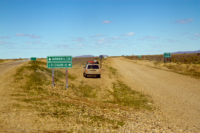
Leaving the newest Ruta 40 for what is said to be the 'old' one ...

Leaving the newest Ruta 40 for what is said to be the ‘old’ one …

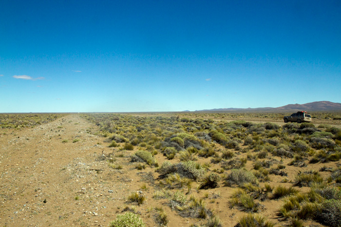
.... only to discover an even older version alongside the new old road ...

…. only to discover an even older version alongside the new old road …

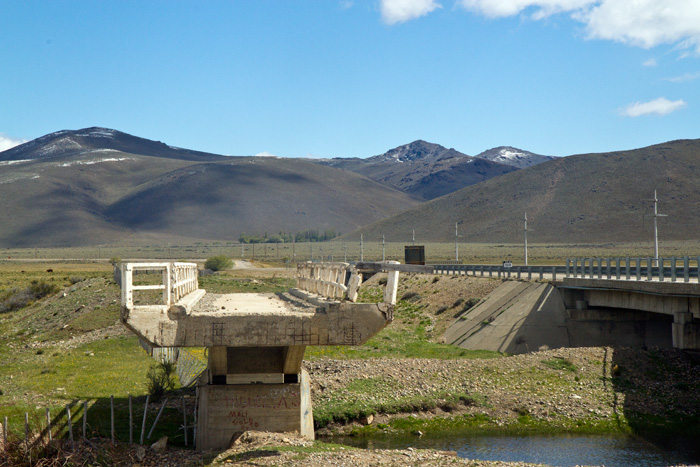
It has slowly become clear that it is not possible to follow the ‘original’ Ruta 40 faithfully. Firstly, because it is not always clear which the original route is; secondly, because the current ‘old’ route often lies alongside a ‘newer’ old route; thirdly because many parts of the route have been renamed and fourthly because some parts have simply disappeared. So we’ll follow the RN40 in spirit, if not always in fact.

This bridge on an older RN40 is clearly not going to allow us across it

This bridge on an older RN40 is clearly not going to allow us across it

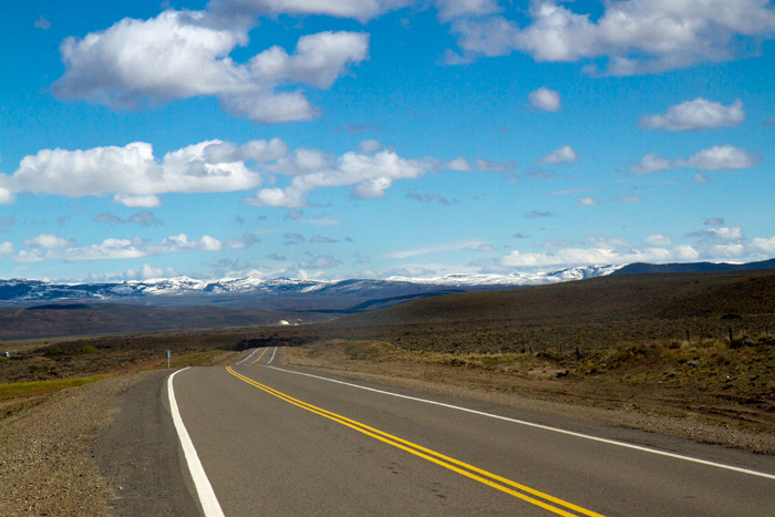
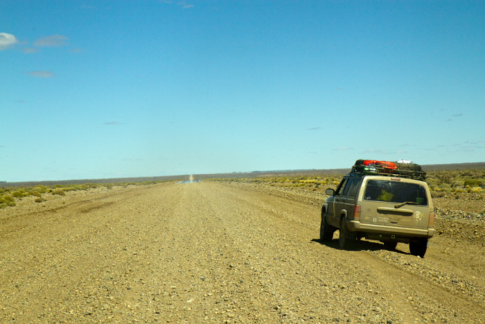
Today we travelled along a variety of roads and landscapes:

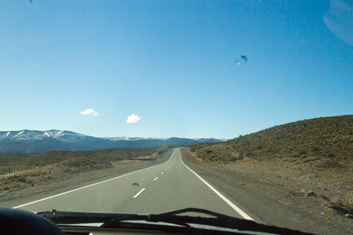
The open road calls yet again ...

The open road calls yet again …

... and again

… and again

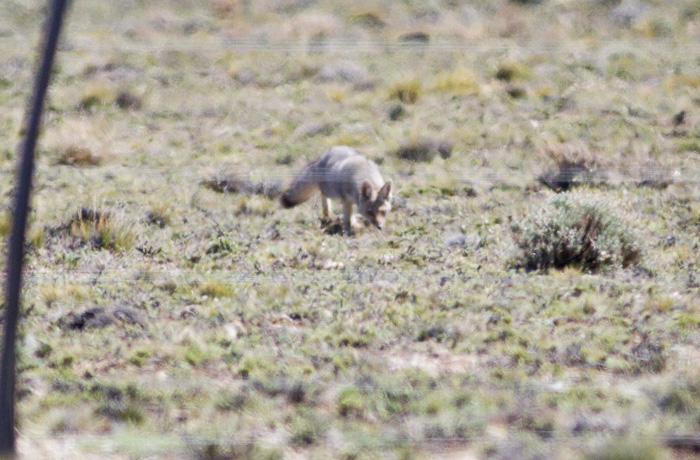
We were lucky to see some of the Patagonian wild life as we drove:

A grey fox ....

A grey fox ….


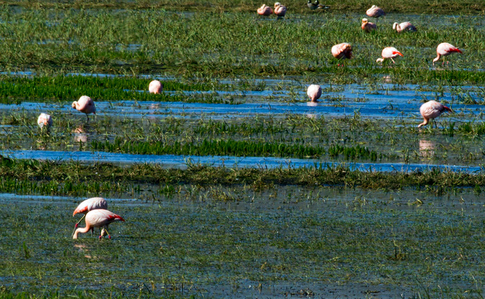
... large flocks of Chilean Flamingos on the lagoons beside the road ...

… large flocks of Chilean Flamingos on the lagoons beside the road …

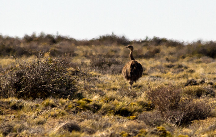
... plenty of Darwin's Rhea (Sp. choique) ...

… plenty of Darwin’s Rhea (Sp. choique) …

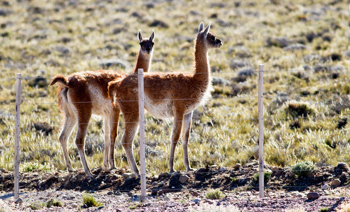
... and numerous herds of guanaco. These two had come down to the highway and seemed unbothered by the Jeep

… and numerous herds of guanaco. These two had come down to the highway and seemed unbothered by the Jeep

We stopped a couple of times to fill stomachs and the jeep: one of these steps was Alto Río Sanguerr …

Filling the tank in Alto Río Senguerr

Filling the tank in Alto Río Senguerr

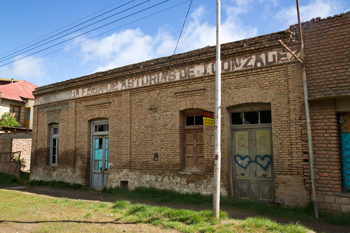
where we saw some lovely old buildings that reminded us of what these southern towns would have been like a hundred or so years ago.

Old building in Alto Río Senguerr

Old building in Alto Río Senguerr

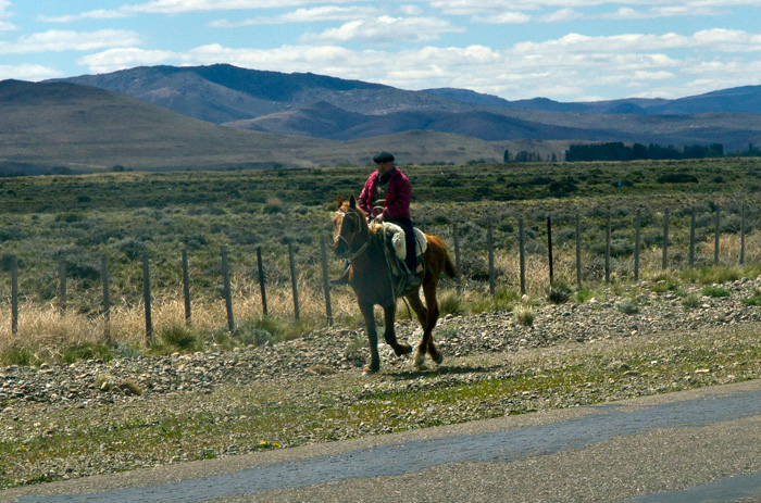
The roads were not completely empty: we saw the occasional sheep farmers herding sheep in the distance and the odd gaucho riding from here to there, but they were very quiet and other road traffic was practically non-existant.

Gaucho wending his way along the side of the highway ....

Gaucho wending his way along the side of the highway ….

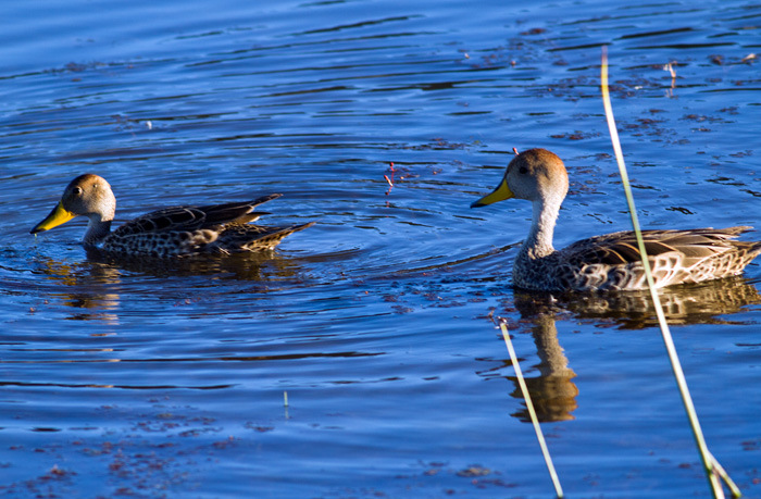
We arrived in the town Perito Moreno in the evening and found a comfortable cabin in the Municipal camping site. Cheap and basic, but fine for the night. A short walk to a nearby restaurant and our day was done. Before turning in we relaxed watching the waterfowl on an attractive lake by the camping site, laid out for the town’s residents.

Ducks on the Perito Moreno lagoon - surrounded by a 1.5 kilometre illuminated walkway

Ducks on the Perito Moreno lagoon – surrounded by a 1.5 kilometre illuminated walkway


RN40 south, day 2

Day: 2
Trajectory:  Esquel – Trevelin – Los Alerces National Park – Cholila – Leleque – Esquel.
Distance covered:   317 km
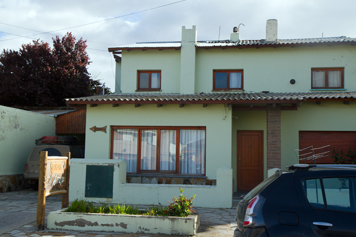
La Hostería El Arrayan in Esquel, where we stayed for nights one and two.

La Hostería El Arrayan in Esquel, where we stayed for nights one and two.

We were up earlyish for coffee and toast and jam. Today was to be a quieter day, spent on a side trip around Esquel. More of a circular trip really, as we drove in a large loop ending where we started up.
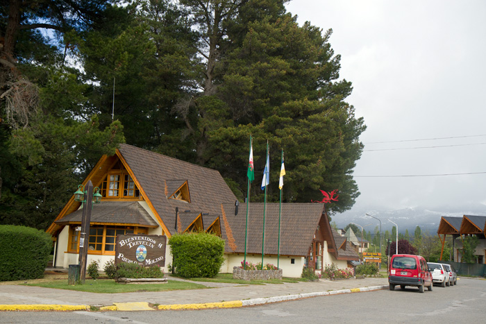
Entering Trevelîn, a growing town that still sports its Welsh heritage

Entering Trevelîn, a growing town that still sports its Welsh heritage

Our first port of call was the nearby town of Trevelín, the town of the mill, founded by Welsh settlers in 1889. Here we had morning coffee with Clare Vaughan, coordinator of a British Council run Welsh teaching project across the Welsh belt of Central Patagonia before moving on. Clare’s work interests me very much, and having made contact we have arranged to meet again on my return journey.
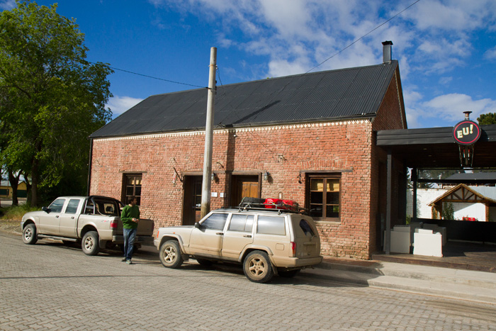
Brick built Bar El Único, where we met Clare, was the first school building in Trevelín

Tis and jeep, outside Bar El Único, where we met Clare. This was the first school in Trevelín

We left Trevelín to drive through the immense Los Alerces National Park with its beautiful trees and views, and skirted a number of lakes. We passed through all weathers in the three hours or so it too us to drive through the Park with bright sun, rain and heavy snow.
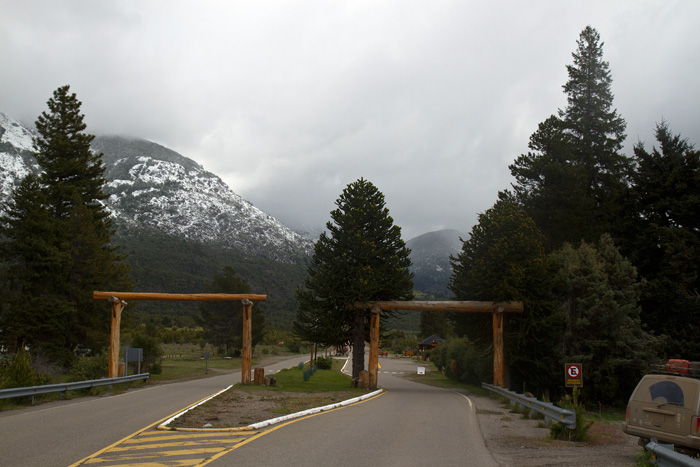
Entrance to the Los Alerces National Park

Entrance to the Los Alerces National Park

The park was brimming with wildlife –we saw and heard an extensive variety of birds– and had a number of trails leading to waterfalls, panoramic viewpoints, etc. The roads were mostly well surfaced, with a little work still to do in parts, but a far cry from the last time I drove this road in the early 1980s.
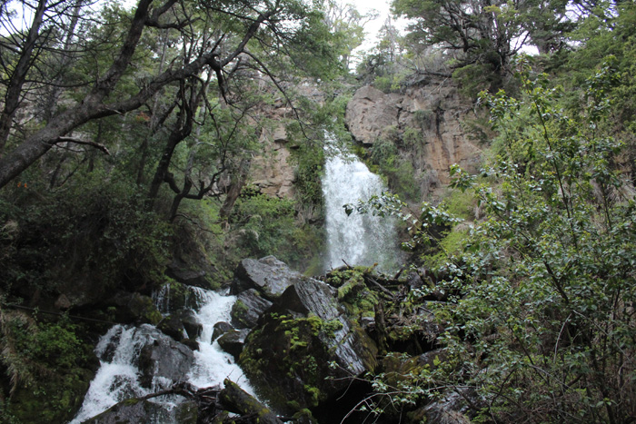
Waterfall in the Los Alerces National Park

Waterfall in the Los Alerces National Park ….
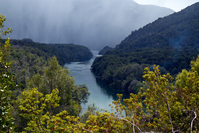
... and a viw over a 'brazo' of one of the lakes we passed

… and a viw over a ‘brazo’ of one of the lakes we passed

Not all the animals we saw were wild; the park was also full of sheep, horses and cattle, the last of which fascinated Tiso who shot half of his photographic allowance on some cows in his bid for the ‘animal of the day’.
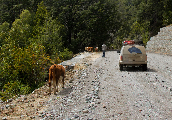
Tiso took a particular interest in the cows - these were friendly and unproblematic ...

Tiso took a particular interest in the cows – these were friendly and unproblematic …
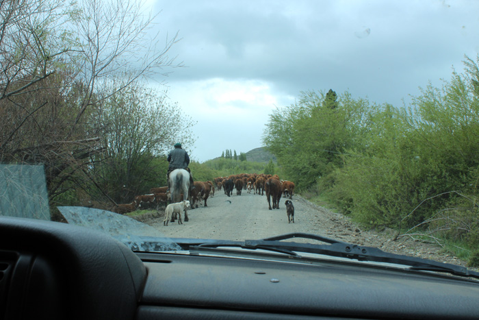
IMG_0916

… while others were not quite as welcome, though we were in no hurry

We came out of the National Park in time for a late lunch at Cholila, founded in 1840 but which has never really taken off and we wondered what work there would be to keep the small population there. We enjoyed a good, filling and reasonably economic lunch at Lily’s Kitchen.
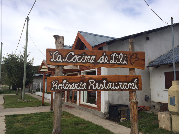
Lily's Kitchen - our choice of places to eat in Cholila (not that we actually had much of a choice!)

Lily’s Kitchen – our choice of places to eat in Cholila (not that we actually had much of a choice!)

Bellies full once more, we set off for Butch Cassidy’s ranch some eight kilometres outside Cholila, passing on the way a small but atmospheric cemetery – a well-cared for reminder of the first settlers in the area.
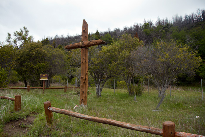
First cemetery of early settlers in the outskirts of Cholila

First cemetery of early settlers in the outskirts of Cholila

Much has been written about Butch Cassidy, and since the 1969 movie and Chatwin’s book In Patagonia interest in him and his ‘gang’ has grown, making his ranch outside Cholila a shrine for western fans. Sadly, much that has been written about him is distorted or just plain wrong, but in this case he really did live at this ranch with the Sundance Kid and the enigmatic Etta Place.
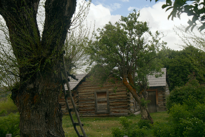
Butch Cassidy's cabin homestead some 8 km outside Cholila ...

Butch Cassidy’s cabin homestead some 8 km outside Cholila …

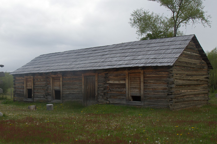
The cabin and two outhouses have recently been restored, and the cabin is accessible, containing three rooms and a surprising number of doors. No inside fireplace (and it was bitterly cold on the day of our visit). We were able to enter, and Tiso took my picture sitting inside: a great memento!
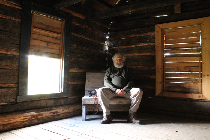
Sitting in one of the three rooms inside the Butch Cassidy Cabaña

Sitting in one of the three rooms inside the [restored] Butch Cassidy Cabaña

We know a little about Butch Cassidy’s life while he was at Cholila, but much is unclear. What happened to him when he left will probably never be known. He may be buried at Río Pico, but that grave almost certainly remembers another American outlaw. He may have been shot in Bolivia, but there are no records and he was never identified there. And he may have made his way back to New York, as members of his family maintain. We shall probably never know, but we do know he was at Cholila.
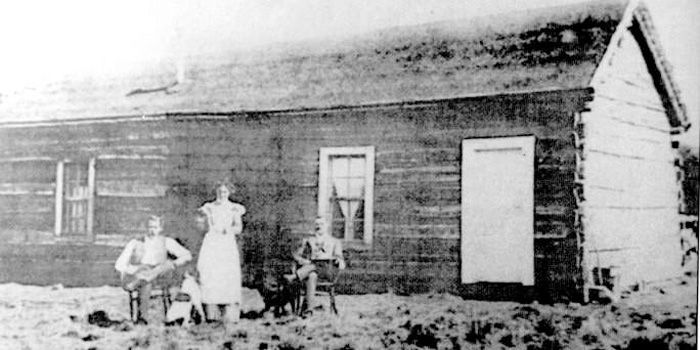
Butch Cassidy, Etta Place and the Sundance Kid (right to left) in front of their ranch cabin in Cholila, Argentina, sometime between 1901-1905.
Butch Cassidy, Etta Place and the Sundance Kid (right to left) in front of their ranch cabin in Cholila, Argentina, sometime between 1901-1905.

The cabaña today

The cabaña today, renovated but in the same place

We left the homestead happy with having made the trip to visit it, and happy too that we had the place all to ourselves to drink up some of the atmosphere. In the height of the tourist season –and there are signs that the site is being developed for that purpose– it would have lost much of its atmosphere.
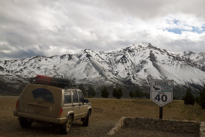
After a long day's drive we return to Esquel

After a long day’s drive we return to Esquel

We set off for Leleque and the RN4O back to Esquel; the same last bit of the route as yesterday and the same destination. Tomorrow we set off south, to Perito Moreno. But more anon.
RN40 south, day 1

Day: 1
Trajectory:  San Martín de los Andes – Embalse Alicurá – El Maitén – Esquel.
Distance covered:   520 km

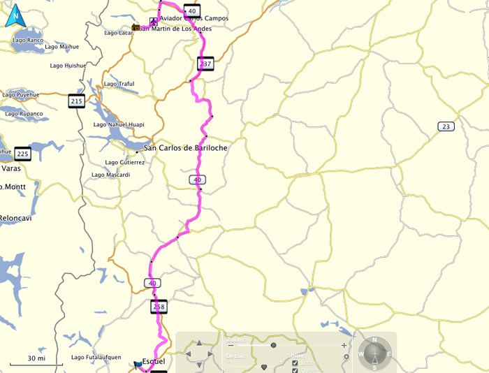
Day 1 - San Martín – Junín de los Andes -  Embalse Alicura - RN2s40  to El Maitén - RN40 to Esquel.

This is the first day of a road trip from San Martín de los Andes to the bottom of the South American land mass. The intention is to follow the RN40 as far as possible and then find a way further south, visiting Ushuaia, Punta Arenas and as far south as I can get on the continent.

For the first part of my trip (as far as Ushuaia) I am travelling with my son Christopher, generally and henceforward known as Tiso. He will fly back from Ushuaia and I will continue for another two or three weeks, working my way up the Atlantic coast in search of wild life; birds, marine life and land mammals.


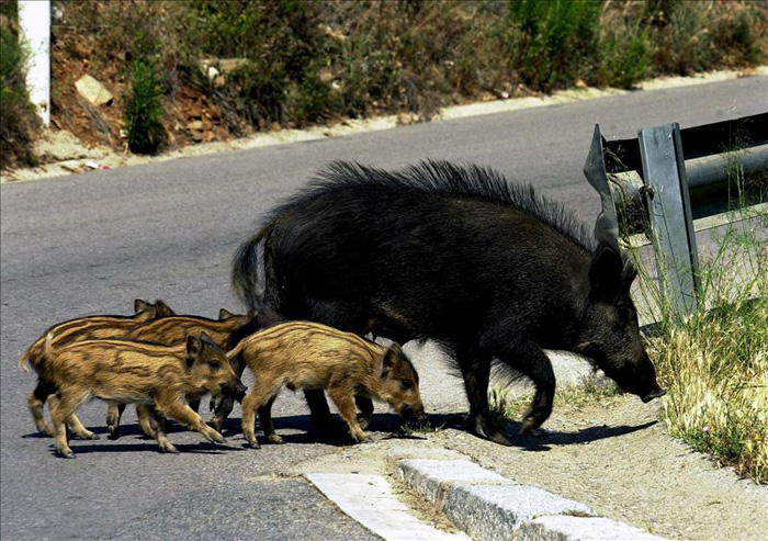
We left San Martin on schedule at 06.00 and drove uneventfully through Junín de los Andes, past La Rinconada and along the Collón Curá valley. The first moment of excitement was an encounter with a family of wild boar who were crossing the highway as they returned from drinking in a water pool. It was the first time of either of us had seen a family of wild boar and this little group –two adults and two or three very small piglets– was a joy to behold, and kept us in good spirits for a good while. Sadly the cameras were in the back of the jeep, so we have no record of the encounter but I include a stock photo to illustrate the event.

Wild boar (jabali) with young - photo courtesy http://www.fadovisa.es

Wild boar (jabali) with young – photo courtesy http://www.fadovisa.es

I travel frequently along this road and for me the journey really started when we hit the turning for Alicurá, the beginning of a long stretch of the old RN40 long replaced by a fast, blacktop highway. This was a new road for me, and in a sense the real start of our adventure.

We turn off for Alicurá, the first 'new' stretch of road for us, and thus the real start of our adventure.

We turn off for Alicurá, the first ‘new’ stretch of road for us, and thus the real start of our adventure.

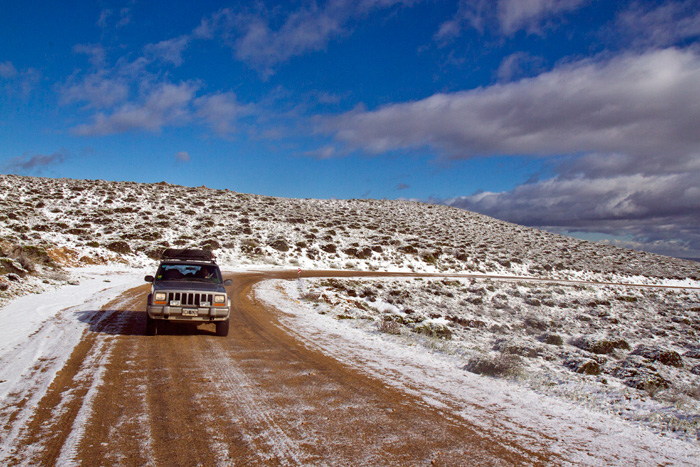
As we climbed higher and higher and the road got worse and worse we found ourselves surrounded by ice and snow, the result of a very heavy snow fall the previous night.

Climbing up the road towards Pilcaniyeu in the snow and ice

Climbing up the road towards Pilcaniyeu in the snow and ice

It was cold up here – it was still quite early in the morning and the sun, if dazzling, was still weak. But the views were spectacular, even if the road was a little variable in its surface.

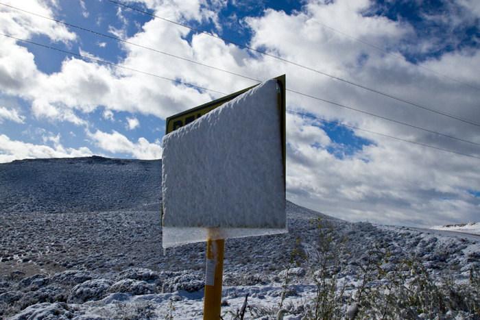
The overnight ice on a road sign melts in the early morning sun

The overnight ice on a road sign melts in the early morning sun

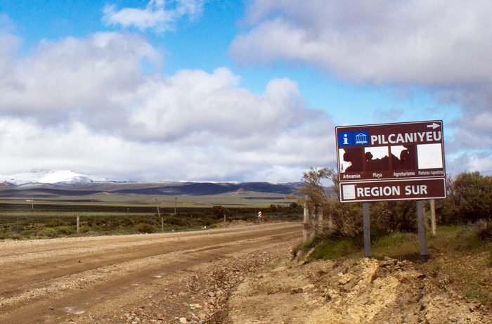
We finally arrived at the first settlement on our trip, the small town of Pilcaniyeu, where we filled up with fuel.

Arriving in Pilcaniyeu

Arriving in Pilcaniyeu

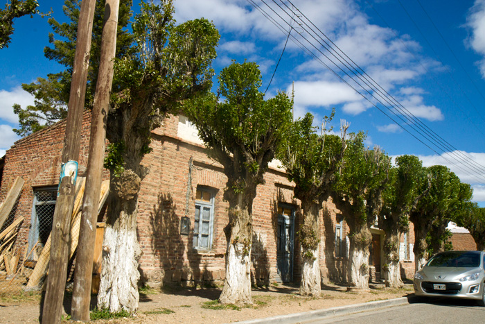
Pilcanieyu is a small place with memories of what were obviously more important days, reflected in its architecture.

Old building in Pilcaniyeu

Old building in Pilcaniyeu

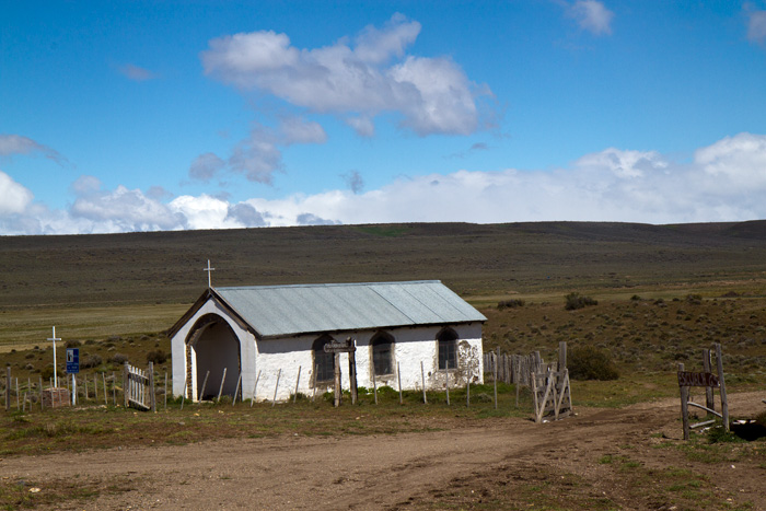
We left Pilcanieyu for a smaller community, Las Bayas, and then drove on to the larger town of Norquinco, passing a lovely old chapel along the way.

Chapel between Las bayas and Norquinco

Chapel between Las bayas and Norquinco

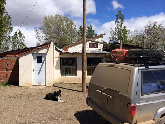
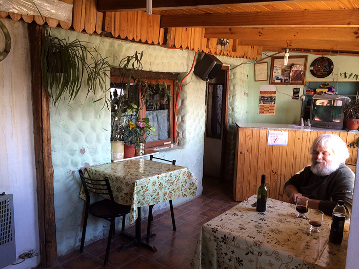
We had lunch in Norquinco, huge milanesa sandwiches that were ridiculously cheap.

An unprepossessing restaurant, but a surprise inside ...

An unprepossessing restaurant,  …

... but great food and service inside, and very cheap ...

… but great food and service inside, and very cheap …

Then back on the road to El Maitén, crisscrossing paths with the old railway line that once united Ingeniero Jacobacci with Esquel.

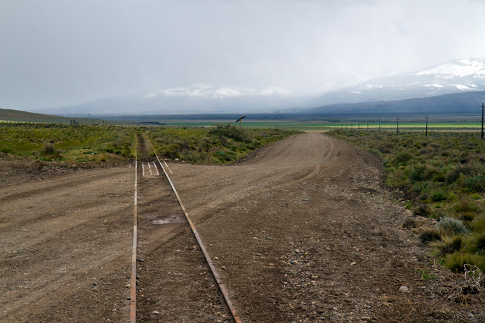
Part of the old line of the Old Patagona Express that once ran from Ingeniero Jacobacci to Esquel.

Part of the old line of the Old Patagona Express that once ran from Ingeniero Jacobacci to Esquel.

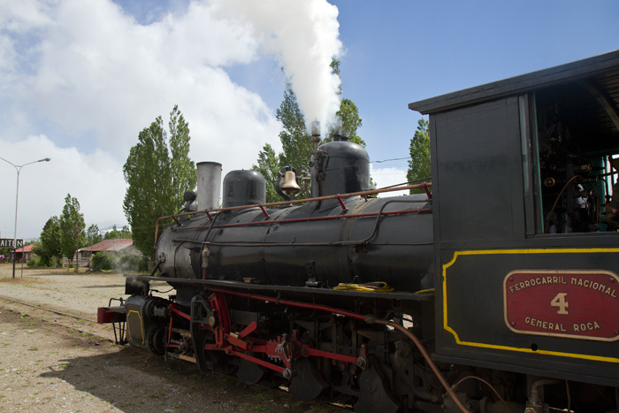
The only part of this famous railway line made famous by Paul Theroux that is still running is the stretch to Esquel from Maiten, a popular tourist attraction which we saw when we reached the latter town.
Train for Esquel gathering steam ...

Train for Esquel gathering steam …

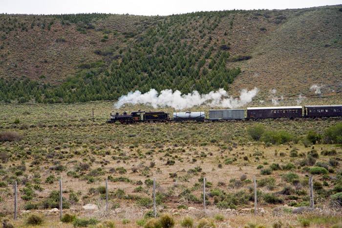
... and in full steam on its way back to Esquel.

… and in full steam on its way back to Esquel.

... and in full steam on its way back to Esquel.

… and in full steam on its way back to Esquel.

We reached Esquel some ten hours after leaving, found our hostal easily enough and enjoyed a welcome siesta. After the remote townships we had passed through Esquel was  a shining metropolis, full of bright lights and attractive businesses. We went out for an equally welcome parrilla and went to bed to prepare for day 2. . Silver the Jeep behaved impeccably, Tiso did all the driving (my turn tomorrow), and Day 1 is done, successfully and enjoyably. Watch this space.

On the road again …

It’s a long time since I set off on a proper trip, one wholly unrelated to work and with no aim other than the travelling itself. And it’s a great feeling to be travelling with my son, away from his work and family commitments for a couple of weeks. It’s going to be good, and I’m really looking forward to it.

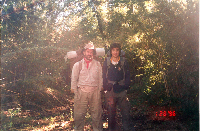
The last proper walk I did (with Tiso and friends), when we walked from the hot springs at Epulafquen to the camping site at Piedra Mala (Paimún).

The last proper walk I did (with Tiso and friends), when we walked from the hot springs at Epulafquen to the camping site at Piedra Mala (Paimún).

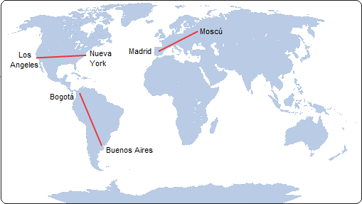
I’m travelling down Argentina’s legendary Ruta Nacional 40 and coming back up the Atlantic coast.  With side trips (and getting lost once in a while) my whole trip will be about 6000 km in total. That is longer than the entire RN40 (5.140 km) – once I get to the southernmost point of South America I have of course to turn round and come back. To provide a little perspective, the distance between Madrid and Moscow is only 3417 km; New York to Los Angeles 4139 km and Buenos Aires to Bogotá 4649 km. I’ve been saving up for the fuel!

mapa_mundi

Comparative distances – image taken from Austin Whittall’s great site at http://turismoruta40.com.ar

The road surfaces will range from freshly surfaced blacktop to long abandoned dirt and gravel roads, but I am confident that our Jeep, hereby christened ‘Silver’ in honour of the Lone Ranger’s horse, will cope. I hope, anyway. Recently serviced, with spanking (and hideously expensive) new tyres and the roof laden with spare tyres and jerry cans of petrol (petrol stations can be 800kms apart and then be out of petrol!) we’ve done what we can – a fifteen year old vehicle can be problematic, but we are gung ho. Sort of.

Easter 1974, Nordkapp, and a rather younger and slightly inebriated Martin

Easter 1974, Nordkapp, and a rather younger and slightly inebriated Martin

Way back in 1974 I travelled to Skarsvåg, a  township (village, really) in Nordkapp, Norway. The northernmost settlement in continental Europe. Forty years later I am aiming to get to Ushuaia, the southermost city in Latin America and then (just to be sure as Ushuaia could be said to be on an island) driving on to Punta Arenas and then south to Port Famine and then even further south, as far as possible, into the Magellan Strait. (Yes, I know that Puerto Williams on the Island of Navarino is even further south but I can see no way of getting there that would not involve a long sea journey. And there are settlements even further south –on Antarctica– but we have to draw the line somewhere).

We leave Thursday morning, 30 October, early. I’ll be blogging the journey, day by day, although it is unlikely that I’ll be able to upload every day given the remoteness of where we are going. If you live in urban Europe or North America it is hard to comprehend the vastness of Patagonia. As Chatwin and Theroux have pointed out, time spent there reminds one that ‘nowhere is a place’.

Next blog at end of day one (we hope).


The Ruta 40 calls …

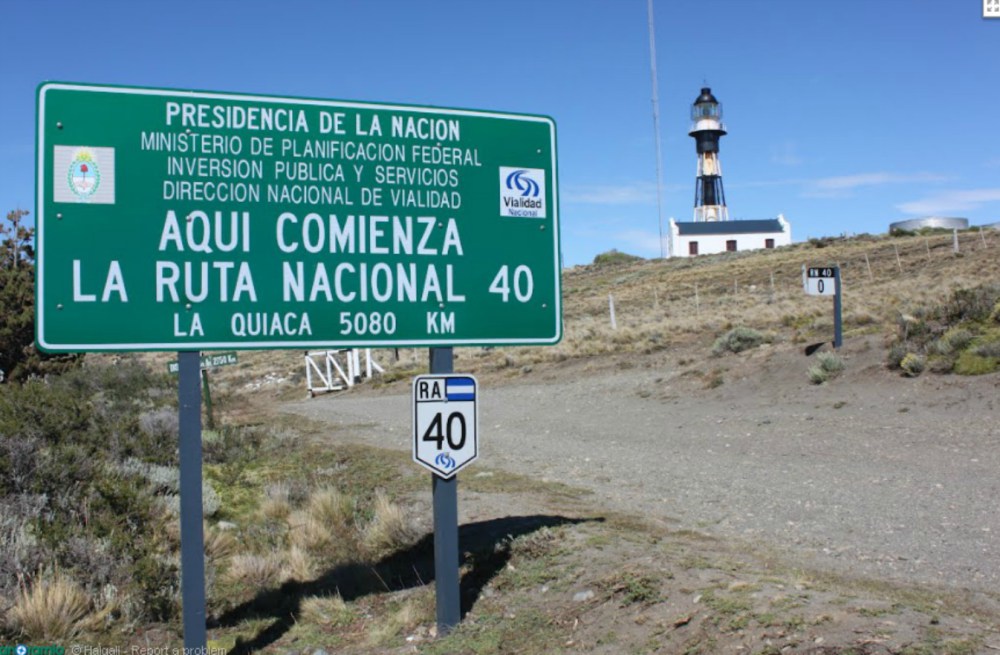
Every trip should have a goal, and this is ours - though not the end of our journey.

Every trip should have a goal, and this is ours – though not the end of our journey.

We are now starting to tick off the last minute preparations before we set off south on our trip down the old Ruta 40. I say old, because we intend as much as possible to follow the 1930s route rather than the modern one. When the national government decided to oblige provincial authorities to tarmac all of the R40 many of them simply renamed other routes as R40 and changed the old names. It’s been quite tough working out the old route but thanks to a great website I found I have managed to more or less piece it together.

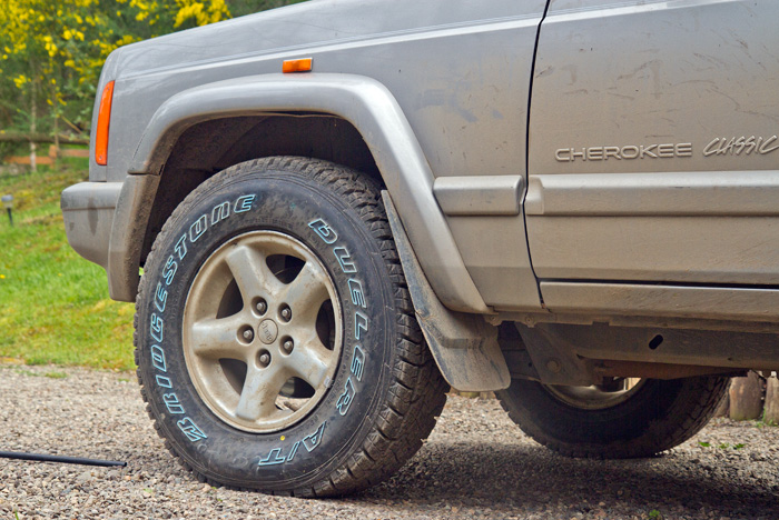
With much of the journey on dirt and gravel roads new tyres were essential (if expensive)

With much of the journey on dirt and gravel roads new tyres were essential (if expensive)

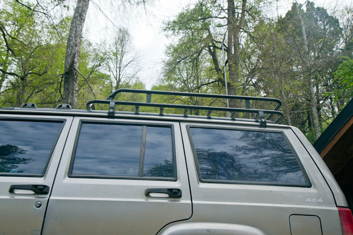
The biggest (and most expensive) issue has been getting the Jeep ready. It is now fifteen years old and has to do a six-thousand km journey reliably, given that we shall be travelling through some very remote places, possibly with extreme weather conditions. This means carrying multiple spare tyres, jerry cans of fuel and water (for car and drinking), spare parts, tools and emergency rations. So far we have bought a roof rack, new tyres (ouch), and jerry cans and have given the Jeep a full service. The service led to a new alternator and a few other little things were sorted. I’d hardly say the Jeep is looking new, but it’s certainly costing a lot to get it ready.

Roof racks were expensive, so we had this one made to size

Roof racks were expensive, so we had this one made to size

I’ve also been working on the itinerary, deciding where to stop each night, where to stay, what to see and what to do. Tiso wants to visit Cerro Paine and the national parks around El Chaltén and El Calafate (I’m keen too), and I have my eyes on some nature reserves.

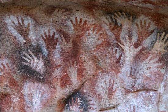
Cueva de las Manos (Cave of Hands) near the town of Perito Moreno in the province of Santa Cruz. Photo from www.patagonia.com.ar/.

Cueva de las Manos (Cave of Hands) near the town of Perito Moreno in the province of Santa Cruz. Photo from www.patagonia.com.ar/.

There will be historic and prehistoric things to see: we shall be visiting ancient rock paintings (e.g. the world heritage “painted hands” site) as well as more modern things such as traces of Butch Cassidy in Chubut.

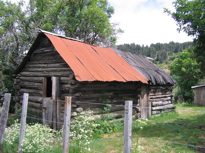
Cabin said to have been sometime home to Butch Cassidy, the Sundance Kids and Etta Place. Photo from http://www.plazademayo.com/.

Cabin said to have been sometime home to Butch Cassidy, the Sundance Kids and Etta Place. Photo from http://www.plazademayo.com/.

There’ll be references from Darwin, Bruce Chatwin, etc. to follow up; the Welsh community to learn more about; all the new fauna and fauna to admire; all in all, it promises to be a great trip.

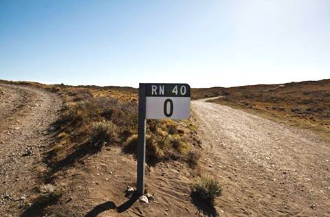
The end (or beginning) of the Ruta 40 in cabo Virgenes. Not the end of the trip though - we go further south. Photo http://www.turismoruta40.com.ar

The end (or beginning) of the Ruta 40 in cabo Virgenes. Not the end of the trip though – we go further south. Photo http://www.turismoruta40.com.ar

The Ruta 40 stops in Cabo Virgenes. Actually it stops in Río Gallegos, the extension being a modern addition, but as it’s further south we’ll add it in. And if possible get down to Dungeness, at the entrance to the Strait of Magellan and the only place where Chile has [minimal] contact with the Atlantic Ocean. Then we go on to Ushuaia, where Tiso flies back and I begin another journey home alone, first south into Chile (Punta Arenas and down to Puerto Hambre) and then up north along the Atlantic coast as far as Peninsula Valdés. But that’ll be another blog series.

Going ahead with Garmin

The plans for our trip south proceed apace. Much of the pleasure of a long road trip lies in the planning of it, and I have been busy these last few days finalising routes, sleeping places, checking daily distances (gravel roads mean we will cover fewer kilometres) and working out where there are (and aren’t) fuel stops. Hard work, but fun.

We have been using Garmin’s RoadTrip and BaseCamp software, set mainly to driving mode but in parts trekking mode when we plan to go somewhere even the Jeep won’t take us. This involves setting up Waypoints all along the route for subsequent export to a Garmin handheld which we can use in the Jeep as a SatNav. At least, that’s the idea.

I have enormous respect for the Argentine Garmin community who through http://www.proyectomapear.com.ar have set up Argentina_Mapear_905_4776, an open source tool that brings together the experience and expertise of hundreds of trekkers, off roaders and travellers, that loads directly onto the Garmin Basemap for Argentina – the finished journeys can be dropped (with tracks, routes and waypoints) straight into Google Earth or exported to a Garmin or TomTom handheld or vehicle Satnav.